|
We
were lucky to find a non stop flight to Iceland. Most of our
other trips abroad involved transfers which adds at least
two hours to our travel times, and often four. And since we
flew over the pole it was only a 7+ hour flight from San
Francisco. Our landing was at 6:30am which gave us a whole
day. But with little sleep we had to find our luggage, our
car, make sure all navigation was working, plus confirm our
room. It started off badly with me grabbing what I thought
was my unique red Swiss suitcase and finding at the rental
agency that it was another persons unique red Swiss suitcase
which could have ruined the whole trip. But luckily in near
panic we were able to navigate mostly Icelandic signs and
found it was still at the airport. After exchanging one red
suitcase for it's clone, our first chore was the Duty Free
store where we stocked up on beer as Iceland tax can double
liquor prices. Our GPS was working well and we managed to
avoid a lot of Reykjavik traffic. Then on to the Grabrok
Crater which has a boardwalk that circumnavigates the top
for a nice leg stretcher and some amazing views. About 4pm
we reached Stykkisholmur, where we spent the night in the
spacious and updated Mar Guesthouse overlooking the bay.
There were really only three outstanding guesthouses for the
price and this was one of them. After being awake for nearly
36 hours, they also had one really comfortable bed. We
wanted to take the ferry across the Breidafjordur Bay to the
island of Flatly the next day, but it was not to be as the
9am crossings stopped just a day before and the 3pm crossing
would have been too late. As usual I spent many hours
pouring over all the self drive tours, guided tours, travel
guides TripAdvisor, etc to find the most interesting sights.
Then plotted them out on a large map and figured the
shortest distance between them to keep driving to a minimum.
This led to a two week clockwise tour of the island, as we
figured inclement weather would hit the north first, plus
most travel guides recommended this direction. |
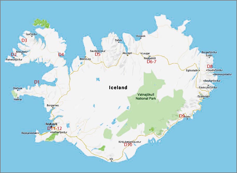 Map of our stays. From the Keflavik airport to Stykkisholmur (D1 in red) was our first days drive. The second day we went from D1 to D2 and so on. Click on to link to a Google Map.
|
 |
|
|
The Osvor Maritime Museum. An authentic
re-creation of an old fishing village from the 19th century. |
|
|
-----------Click to enlarge most pictures-------- |
|
|
Our destination for day 2 was Patreksfjordur. Unfortunately there were few interesting stops along Hwy 60 (why we wanted the ferry) plus it included quite a few dirt roads which shook and rattled our little Suzuki 4X4 in spite of going fairly slow. Still the scenery was gorgeous. The following day (3) we headed to Flateyri with a stop at the Dynjandi waterfall which was very impressive and well worth the 1/4 mile or so climb to the base. I won't mention all the little stops we did at the many sights along the way for fear of people falling asleep, but we'll have a separate list for those seriously contemplating a trip here. Going from Flateyri to Isafjordur on day 4 we encountered one of our first Icelandic tunnels. Many of them are one way, very long and free. So what do you do when going the wrong way? Well as traffic is so light, they have turnouts every 1000' or so and you simply pullover and let the other fellow by. |
 |
 |
|
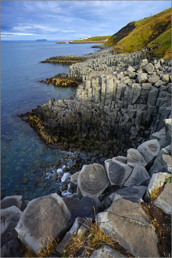
| Closeup of the Osvor Maritime Museum house construction. | Basalt columns on the shores of Hofsos. |
|
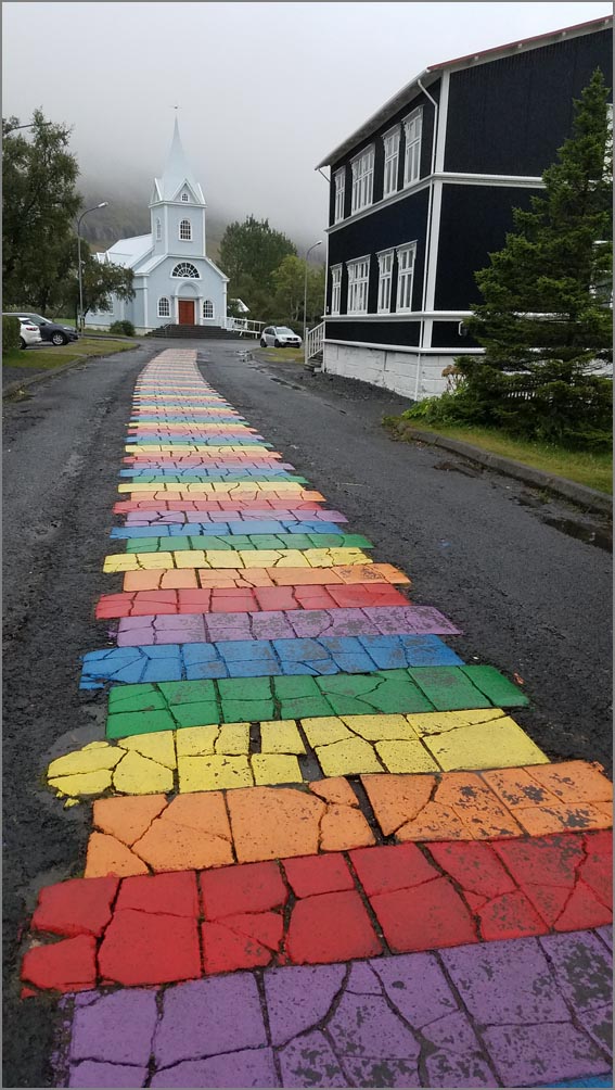
Isafjordur is the main town in this area and well worth visiting. It's large enough to have a walking tour and you could probably spend a day or two here. As we had a little extra time we backtracked to Bolungarvik, not to see the town, but for the scenery. But the highlight was the very authentic little fishing village at the Osvor Maritime Museum. It was closed, but the main part was outside and we were free to walk this fascinating re-creation. (Iceland is similar to other tourist destinations in that they have only two seasons. The jam-packed-tourist season and the everything-closed season.) |
|
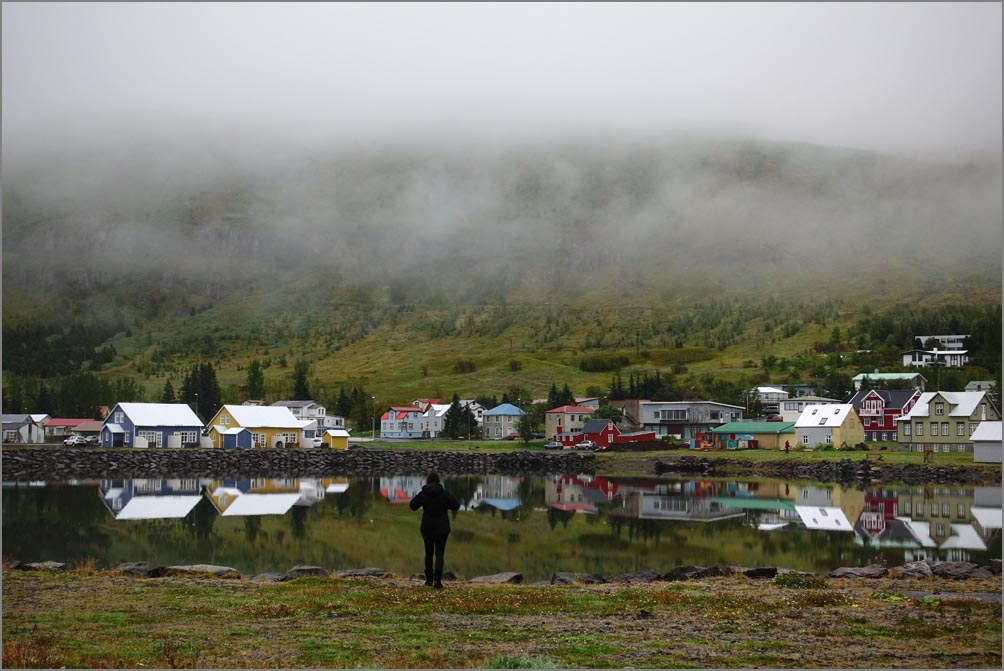
On to Holmavik for day 4 where the Strandir Coast from Holmavik to Nordurfjordur is suppose to be exceptional but we simply lacked time to see it. But this was to be expected as I scheduled more than we had time for, as this let us choose interesting sights and bypass uninteresting ones. From Holmavik to Saudarkrokur on day 5 we encountered more dirt roads, but not as bad as before. And even with a bit of rain the coastal sights were mesmerizing. The two main stops here were the small but charming Vidimyrarkirkja church run by volunteers and the Glaumbaer Folk Museum. Both well worth visiting. In Saudarkrokur we stayed at the the Gamla Posthusid, one of the nicest places of the trip where a transplanted and personable Australian lady turned an old post office into a spacious modern guesthouse, hence the name. |
 |
 |
|
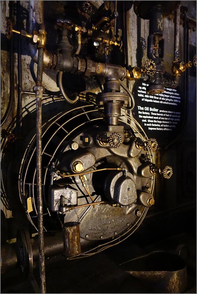
The Herring Era Museum in Siglufjordur. Unfortunately it was closed when we arrived. But many buildings were still open for exploration. |
Some of the machinery at the Herring Museum. |
 |
On day 6 we headed from Saudarkrokur to the Lake Myvatn area, a tourist mecca. Here we encountered our second free tunnel... or so we thought. On the way out we spotted a sign in Icelandic which suggested we should pay. Going by at 50 mph we noticed small letters in English that gave a web site and punitive damage if you don't pay within 3 hours. On getting to our guesthouse, about 4 hours later, we anxiously managed to log on, pay, and tried to explain the situation. It appears they had pity on us and said they got our $20 (normal bridge fare) and there was no penalty. The good news (for Icelanders) is after a few years it's paid for and the fare is free forever. Unlike California where after they pay for a bridge, the fares are hiked continuously in perpetuity as the funds are diverted to other uses. | |
| The harbor at Saudarkrokur. |
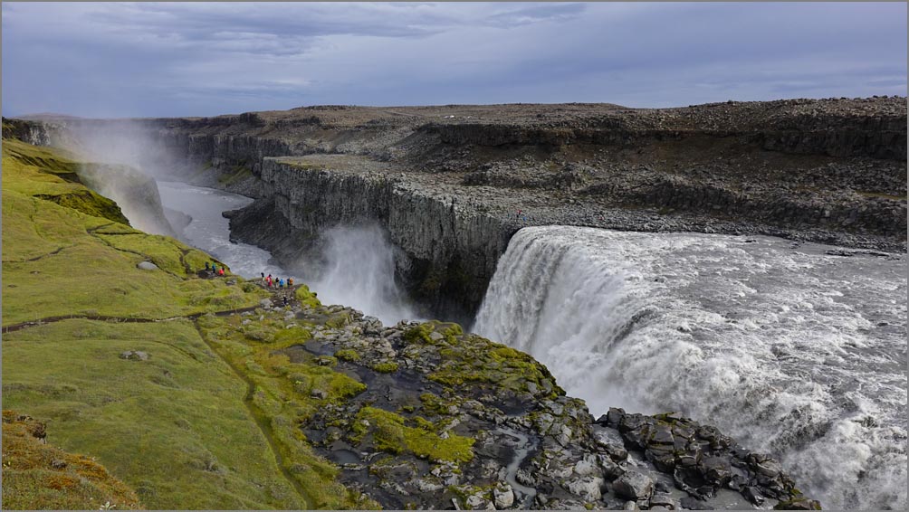 Dettifoss Falls. Note the people center left for scale. |
| On day 7 we headed to the Vatnajokull National Park from our Myvatn base, about a hour north. We stopped at the amazing Dettifoss falls before continuing along the dirt roads to the park headquarters where we hiked the lush and beautiful Asbyrgi canyon. |
 |
 Botnstjorn Pond within the Asbyrgi area. An amazingly blissful wooded corner of Iceland. |
|
| Asbyrgi in the Jokulsargljufur park. |
|
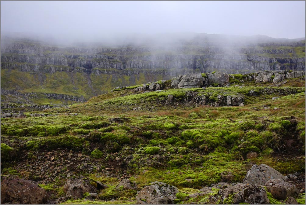
On day 8 we took in the Hverir area, which was nice, and the Krafla area which had an interesting but overcrowded (and muddy) trail around the top. My feeling is the main attraction here is the Leirhnjukur Lava Fields. Most people from this point around the ring would opt to stay in Egilsstadir as it has the most hotels and is sort of an Icelandic version of a USA strip city. But we chose the quaint little coastal village of Seydisfjordur instead. We arrived through horribly dense mountainous fog but it cleared near town where we checked into our lovely historic Hotel Aldan with it's antique filled rooms. As it was about 6pm, we took a short walk through the old town to a charming little brew pub for a pint and then had a home cooked meal of local fresh fish before retiring. |
 |
 Just a local farmers field on the way to Seydisfjordur. |
|
| The Leirhnjukur Lava Fields with miles and miles of trails. |
 |
 |
|
| Hverir geothermal fields. | The main street of Seydisfjordur, a charming coastal town. |
| On day 8 we worked our way from Seydisfjordur to Hofn. It would have been nice to have had the time to see the Litlanefoss falls set among columnar basalt but it was almost 50 miles out of our way. We took 939 instead of following 95 to Breiddalsvik saving us more miles and the sights were amazing with us stopping as much as possible to take a few shots or short hikes. Those with more time (and we had two weeks) might opt for the other route as we hear the scenery is also sublime. |
 |
 |
|
| The harbor at Seydisfjordur | The amazing cliffs on Hwy 939 from Seydisfjordur to Hofn. |
|
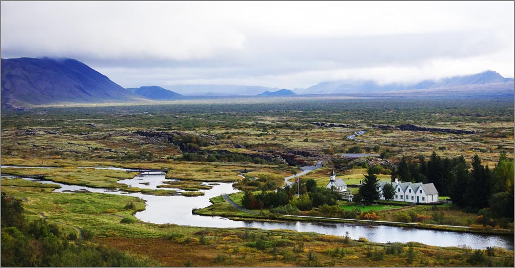
The main attraction of the south central coast is the Vatnajökull National Park and it's glaciers. Svinafellsjokull was a remarkable short hike to one of the closest of them, but down a fairly bad mile long dirt road. There are several other hikes as well, but we only had time for the Svartifoss, it's main attraction. It was like joining a parade of people marching along but still fun. Our last two days were at Reykjavik. We dreaded this due to traffic, paid parking everywhere and all the codes to our self service hotel (to keep the prices down I suppose). But the place was large, modern and we could walk to most places. The next day we revisited the Pingvellir National Park. 5 years ago we did this but Mimi was in crutches. This is a wonderful scenic park you can spend much of the day at with lots of scenic trails, but be prepared for crowds. There are many more sights in this area but we saw them years ago and are covered in our earlier visit. |
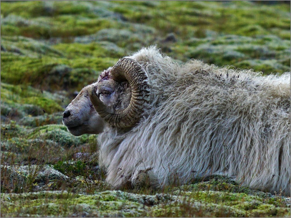 One of the local rams. |
 |
|
| Just a fun evening shot from our hotel around Hofn. |
 Our hotel in Hofn again. Comfortable but not unique. |
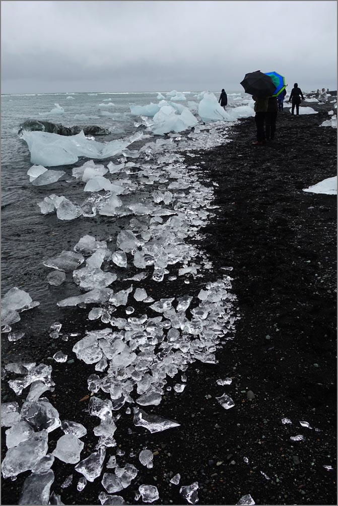 The amazing 'Diamond Beach' close to Jokulsarlon. These are all glacial 'chips'. |
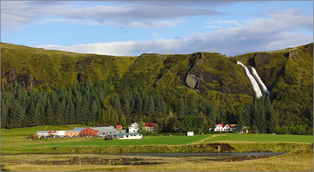 Our guesthouse in Kirkjubaearklaustur locally known as 'Clauster' has a waterfall in it's backyard. Unfortunately we didn't have time to take it's trail to the top. |
 |
|
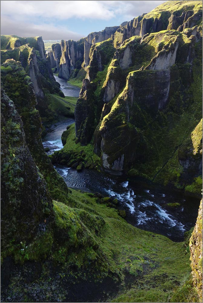
| The convoluted and scenic Fjadrargljufur Canyon has a nice half mile trail to the top. |
 |
 |
|
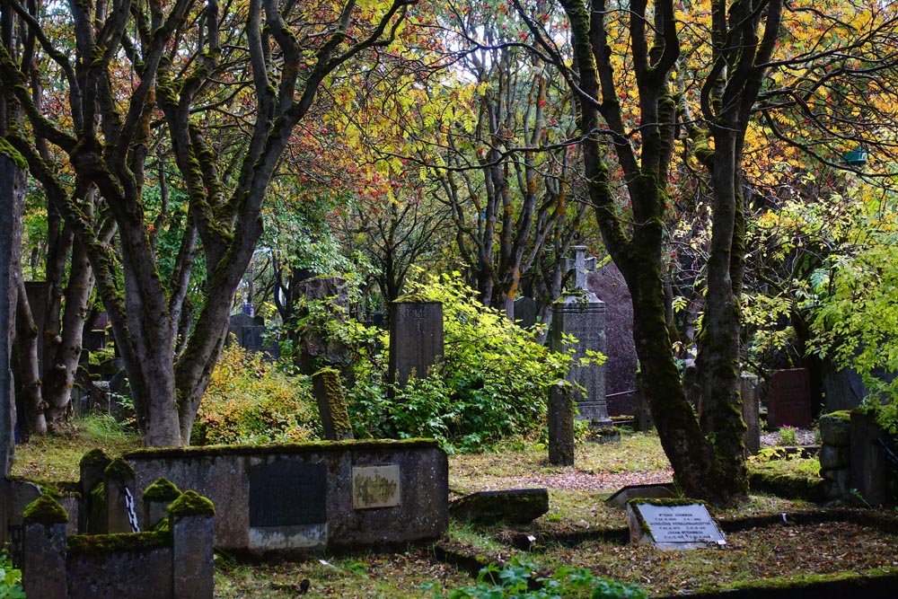
| Thingvellir National Park, a national treasure with lots of trails. | Holavallagardur, Icelands oldest cemetery and a place of botanic wonder. |
 |
 |
|
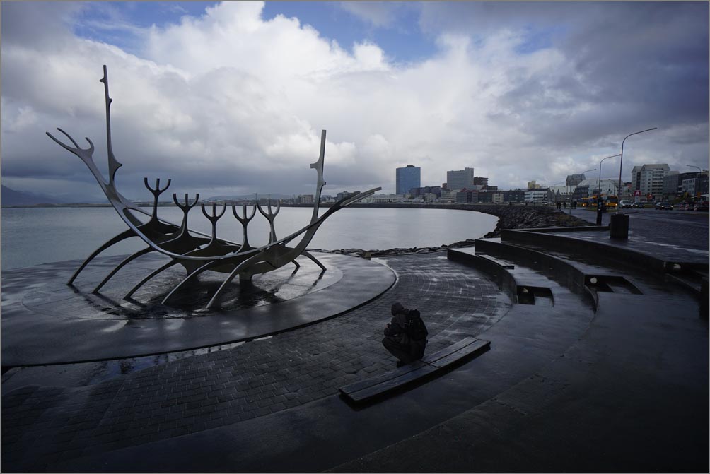
| One of the most iconic scenes of Reykjavik. | One of the nicest Viking replica ships we have ever seen at the Viking World Museum close to the airport. |
|
In Summary.
We were in Iceland about 5 years ago, and in spite of being later and with WOW airline having gone out of business, there were more tourists than ever. But mostly along the Golden Circle route or Southwest Iceland. Phoning: The USA exit code (to call another country) is 011 and Iceland entry code is 353. So from USA cell phones, call 011 353 and the local number. So if you see the local number listed as +354 869 3185 (or simply 869 3185), on your phone call 011 354 869 3185. Your phone may vary depending on carrier. Money: The Krona: is worth about .8 cents. Remember, Europe usually uses the period vs our comma. If you look at the asking price of about 32.000 Krona, move the decimal place one to the right $320.00 and reduce by about 20% (-$64) to $256. you'll be close. That will buy you a hamburger. |
| For a Detailed list of all sites & coordinates day by day: click here. | ||
|
For Photo buffs:
|