|
This year we are hitting the desert trail down south again
which seems to promise good weather. One of the few places we haven't visited are the mountainous areas just west of Anza Borrego and Palm Springs, specifically the Santa Rosa and Laguna Mountains. As usual we were loathed to make reservations as they tie you to a specific place at a specific date and their transaction fees keep increasing. |
|
DAY 1 |
 |
|
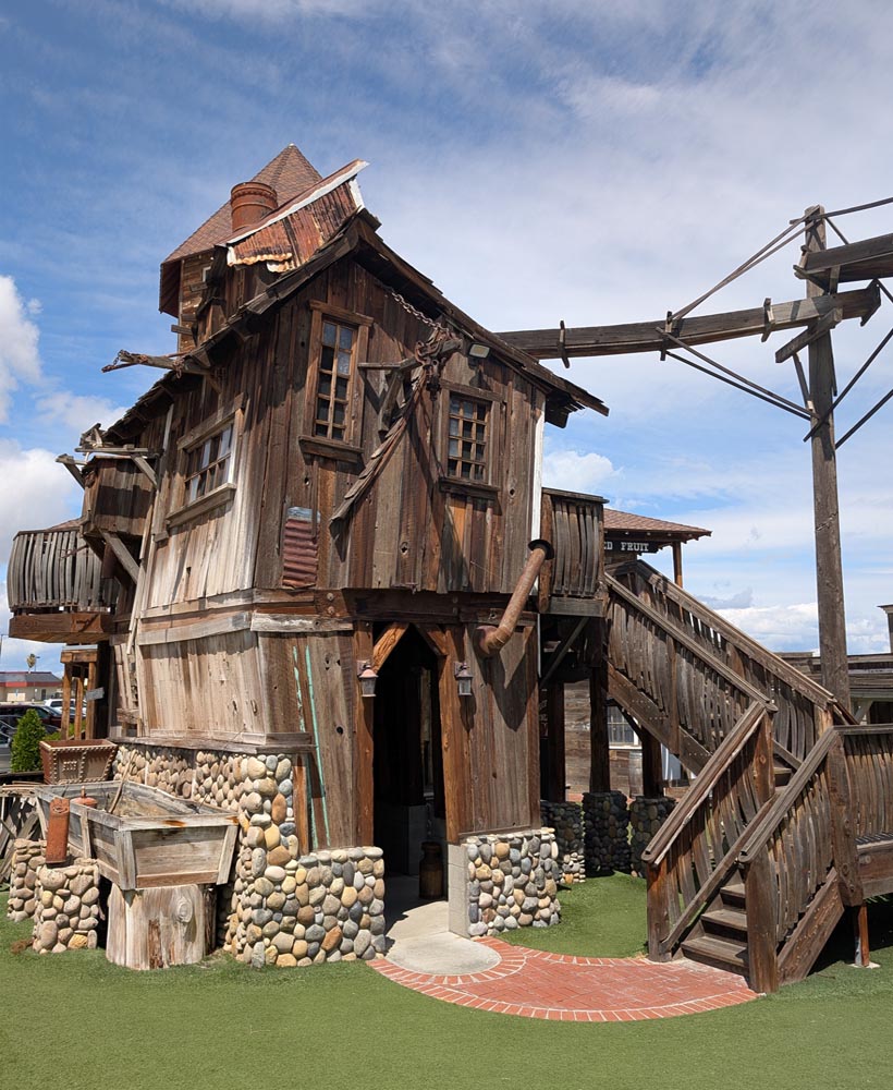
| Bravoland, a little entertainment for kids and seniors |
 |
 |
|
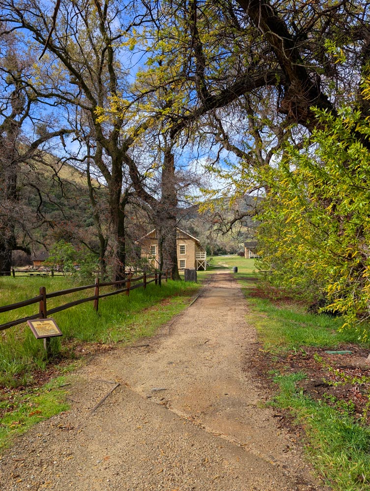
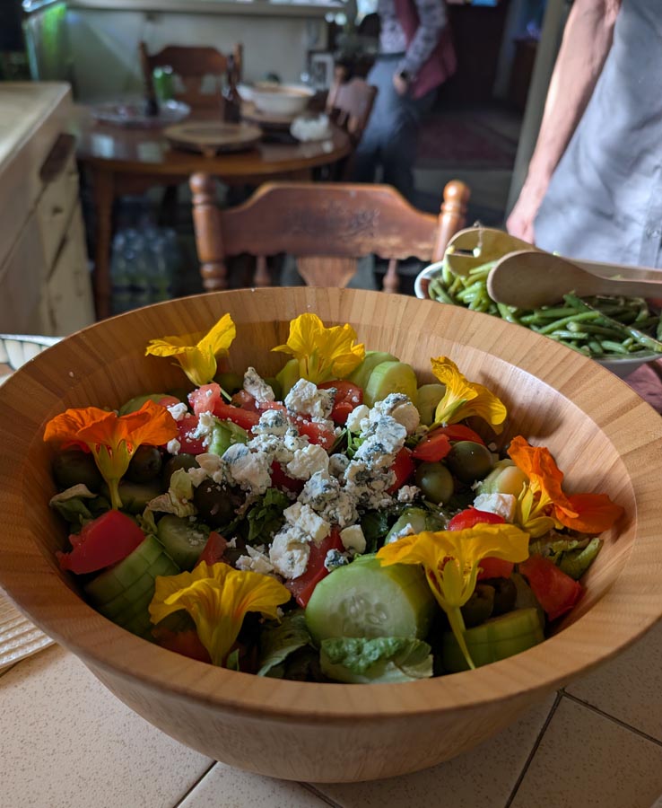
| Fort Tejon. A wonderful bucolic park in a rural setting. | Another great meal. Some of it straight from the garden. |
|
Day 2 We got an early start as usual and headed down Hwy 5 to the 'Grapevine' so called for the wild grapes which use to grow there in the early days but now refers to the steep climb over the San Garbiel Mountains. We stopped part way up at the old Fort Tejon we haven't visited in years. Established in 1854 it was abandoned after only 10 years but is preserved today and includes a small museum. Our second stop was the California Botanical Garden, a sprawling delightful oasis of greenery at the foot of the Gabriel mountain. We took some trails missed before and then headed to Mimi's brother where we had another delightful meal and pleasant evening complaining about world events and getting older. |
||
|
||
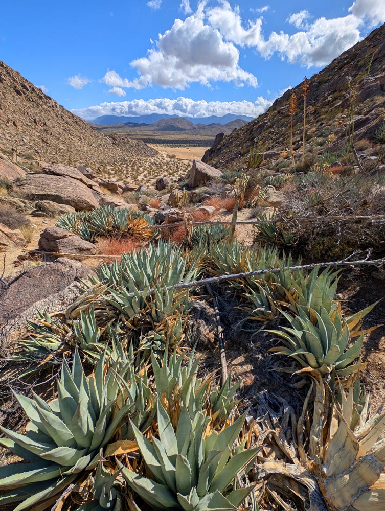 |
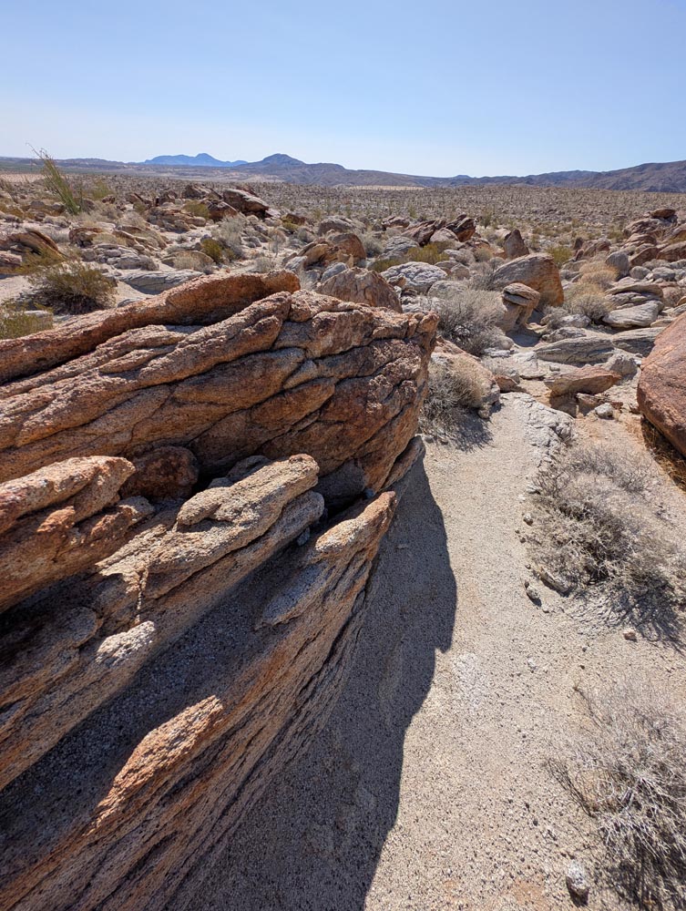
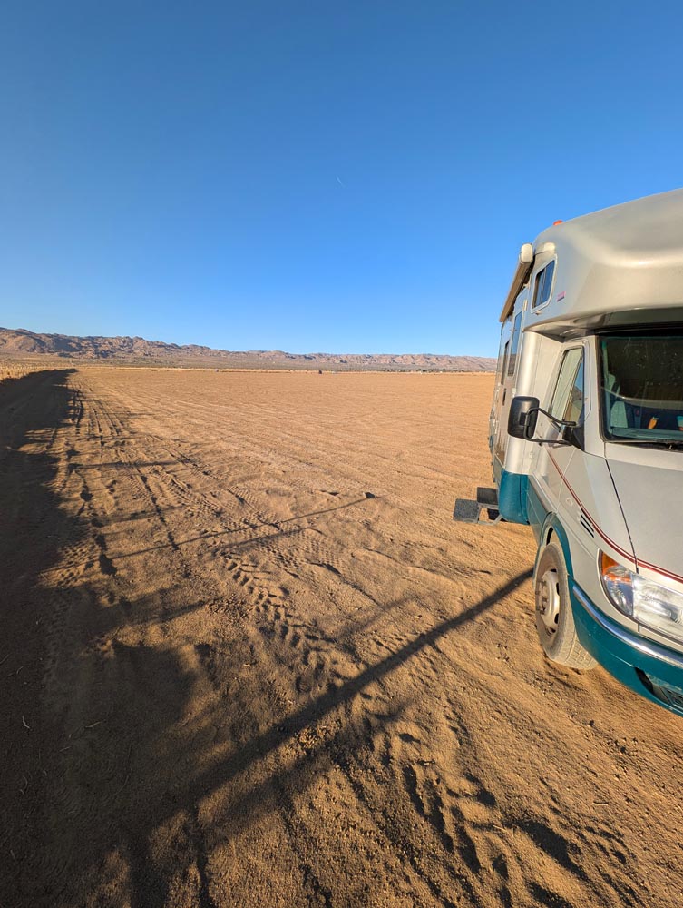
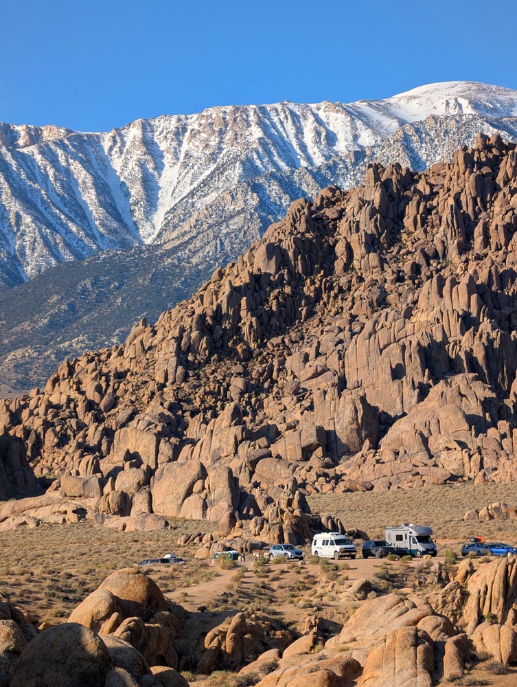
Day 3 We had taken Hwy 79 south before, but this time thought we'd explore Hwy S1 or the Sunrise Hwy overlooking Anza Borrego. At first we feared another heat wave. But it cooled dramatically approaching Julian. There we donned our jackets and toured this quaint tourist town in blustery cold winds. On a whim we went to the Visitors Center and a resourceful lady said S1 may be closed due to snow as an upcoming storm was set to drop temperatures into the twenties. This put a serious crimp in our plans as snow camping was out. After a frenzy of weighing options we decided to cut out a day here due to snow, and another day later on due to being equally high in the Santa Rosa mountains and head directly for for Anza Borrego and spend an extra day in Joshua Tree. Again, luckily we had no reservations to change and while Anza Borrego was only about 12 miles away our campground was about twice that. The Blair dispersed campground was a favorite of ours. Miles of open desert views with a nice succulent covered hill nearby for hiking and all free with plenty of flat space to park. After a nice hike over the hill we found a flat spot and settled in. |
|
| The hill trail at Blair dispersed campground. |
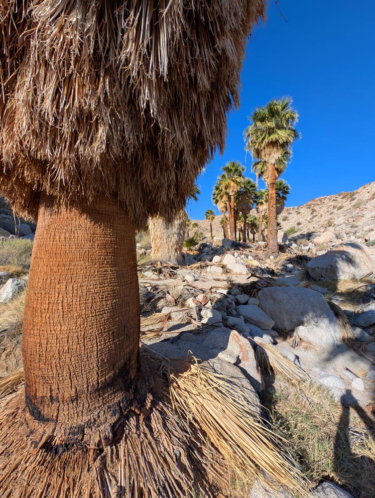
| Day 4 It was cool outside, about 40 degrees, but a big improvement over the 20 up on the mountain. Our catalytic heater kept us warm without noise or electrical usage sipping only small amounts of propane and feels just like a fireplace. We had planned a day of hiking while slowly heading towards our next campground Mountain Palm Springs. It was dispersed but this time they asked for a fee of $20 due so some conveniences, but it was a modest sum we were glad to pay. Our first hike was the old overland stage route which was mostly just a straight dirt road used a century ago and is now part of the Pacific Coast Trail. The next hike was close to Agua Caliente called the Moonlite Canyon trail which I had known about but never had the timing to take. It was a great hike around this small mountain which went from low open desert to a wide slot canyon and then crested a hill with views that stretched for miles. After lunch we headed for our campground and had just enough time to take part of the North Grove trail which went to another unique palm grove before settling in for the evening for a gourmet meal of mixed leaf salad with home made dressing followed by stir fried Spam and potatoes. It's amazing how good Spam is when camping. We just don't let our friends know we eat that stuff. |
 |
|
| The 'North Grove' out of Mountain Springs Campground. |
|
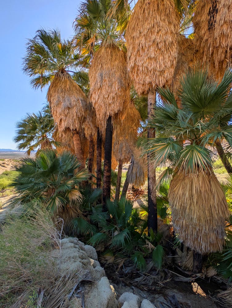
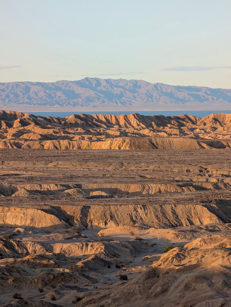
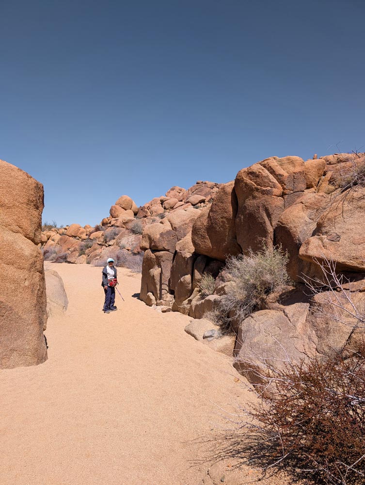
Day 5 After a hearty breakfast (of leftovers) we dressed up for our most anticipated hike to three palm groves. The first part of the hike was fairly easy being down a flat wide river bed or arroyo. The Pygmy Grove was great, but the Southwest grove was amazing having perhaps fifty or more trees measuring forty feet or higher and verdant. A unique sight in the somewhat barren tan surroundings. After taking a dozen photos we headed back to confusing signs that didn't match my Gaia GPS map trails. We opted to leave our un-mapped but clearly heavily traveled river trail for the mapped Gaia one. While a regular trail it was so faintly marked in places we often had to wander back and forth to find it again. On a whim I went up the river trail from the other end and think it would have been the better choice. After that we headed for our next dispersed campground at the north end of the park. After getting propane and a few groceries in Borrego Springs we went to the park headquarters to look over the museum, but were so disappointed with the parking and paying hassle we just went back to town and looked over some of the charming little galleries including one art garden where an exceptionally friendly fellow just gave us some cuttings. Off to our third free campground from where we could watch the sun set over the whole of the Salton Sea from high up on a desert mesa. |
 |
 |
|
| Part of the giant 'Southwest' grove. | Struggling to find the trail on the way back. |
 |
 |
|
| Our view from the mesa overlooking the Salton Sea on day 5 | And our view on day 6. Dirtbikes zoomed within 5 feet of us. |
|
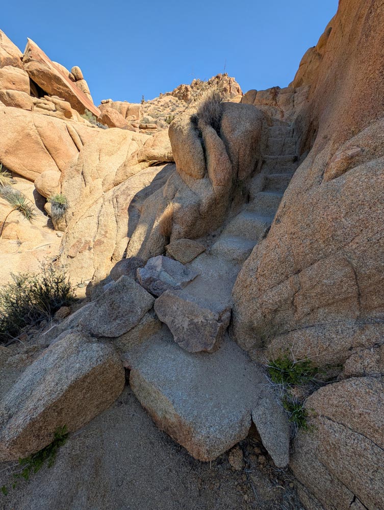
Day 6 We were in need of a dump and water and it's often a struggle finding a place when you dry camp. Luckily we found an Indian casino where not only did we dump for free but they had free drinking water also! Plus their diesel was only $4.09 per gallon, so we topped up our tank as well. On to Joshua Tree and the Cottonwood hike which was one of our favorite as it winds though sandy succulent filled desert among bazaar rock formations and even has an old mine all on a well developed easy to navigate trail complete with steps carved out of stone in some of the more difficult places. After that it was on through Joshua Tree looking for another short trail. But as it was a weekend every good trailhead was full and the only one with a large parking area was under construction. Oh well, off to another disbursed area north of the park. This one was a campground of convenience rather than a destination, as it was just a dry dusty barren open space north of Nine Palms that seemed to served more as a race track for ATV's and dirt bikes than campers it seems. The only saving grace was things quieted down with the setting sun. |
 |
 |
|
| One of the many stairs at the Cottonwood hike | But it also had it's washes. |
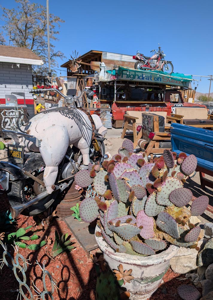
| Day 7 Today our next destination was up 395 towards Alabama Hills just east of Lone Pine. As we went through Adelanto we spotted this unusual place full of what looked like junktiques. On stopping for a closer look found it was an open air restaurant bar haven for bikers mostly. We took another hike about 40 miles further up but it was unremarkable. Then our GPS got confused due to new construction, and found much of the old quaint 395 is four lanes now. While the Alabama hills were still enchanting, it has become over regulated. Our former open and free camp anywhere sites were now limited to a few places and you had to register to get one. Plus they were off road and we did a bit of near rock crawling to get to one pushing up our generator exhaust but luckily it was easy to bend back. After settling in we took a short hike before retiring for the evening. |
 |
|
| In spite of it's crusty exterior, this biker bar had friendly people. |
 |
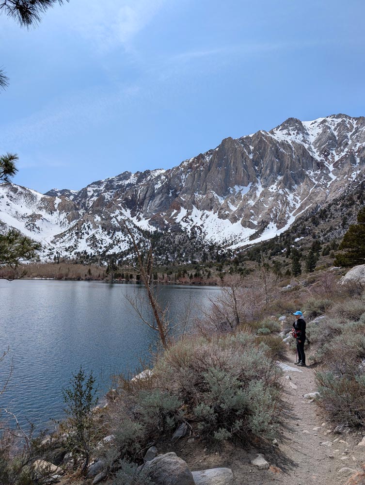
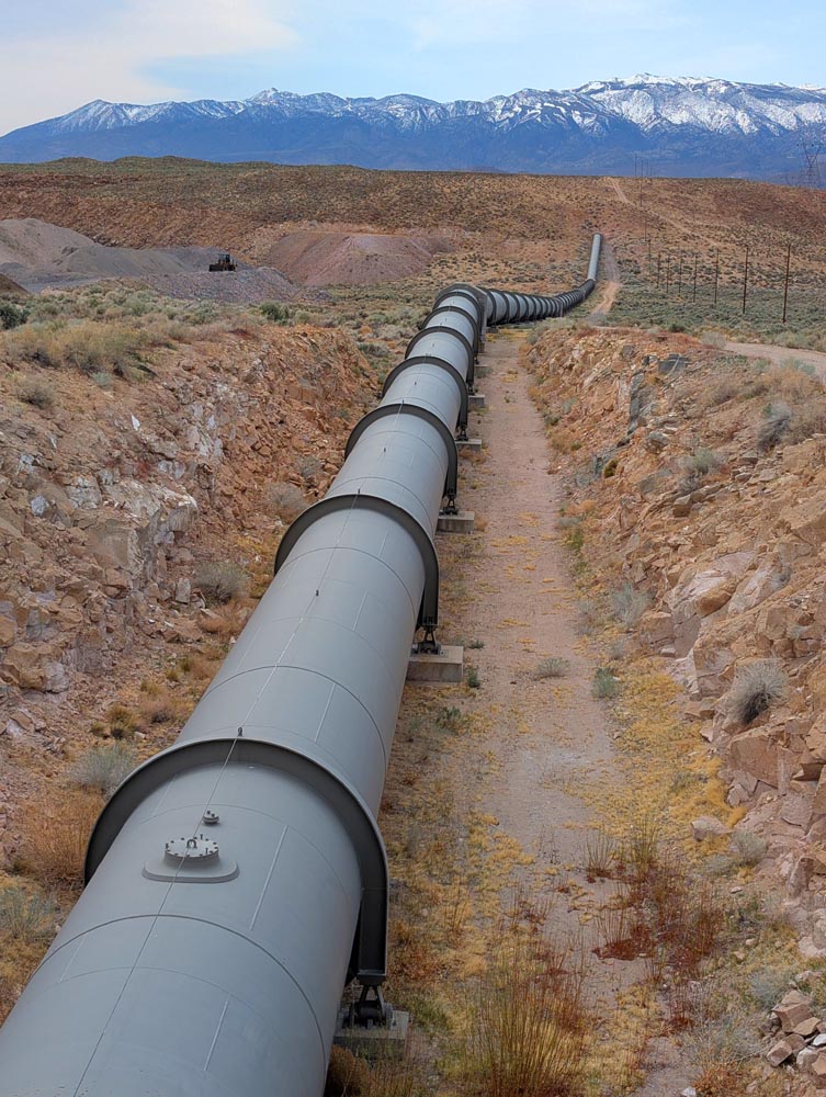
Day 8 There are limited official trails here and one of them is the Mobius trail, a world class desert hike through amazing rock formations, plant life and views of nearby snow capped mountains which includes the 14,000' Mt. Whitney. After that amazing hike we headed for our last campground near Mono Lake. It's an RV park we normally eschew but this one is very pleasant. The main reason is that temperatures here at about 6500 feet will get very cold and we plan on spoiling ourselves with an electric heater running all night to keep temperatures near the upper 50's. Our first stop was to the Owens River Canyon and the electric generation there which sounded interesting on paper. The canyon wasn't that impressive but the pipe supplying the generation station was. On to the McGee trail in the Sierras. After miles on a dirt road which kept getting narrower and was headed for snow, we decided to give that one up. On to Convict Lake which didn't sound that good, but it was one of our better hikes. The trail went around a pristine blue alpine lake with snow capped mountain on one side and green floral hills on the other. We could only go to the end of the lake before hitting snow, so didn't circumnavigate. Perhaps another year as it's so enchanting it's worth trying again. |
|
| One of the amazing views from Alabama's Mobius trail. |
 |
 |
|
| Convict Lake and part of the breathtaking trail. | We thought this Owens River pipe small until we got close to it's 12' diameter. |
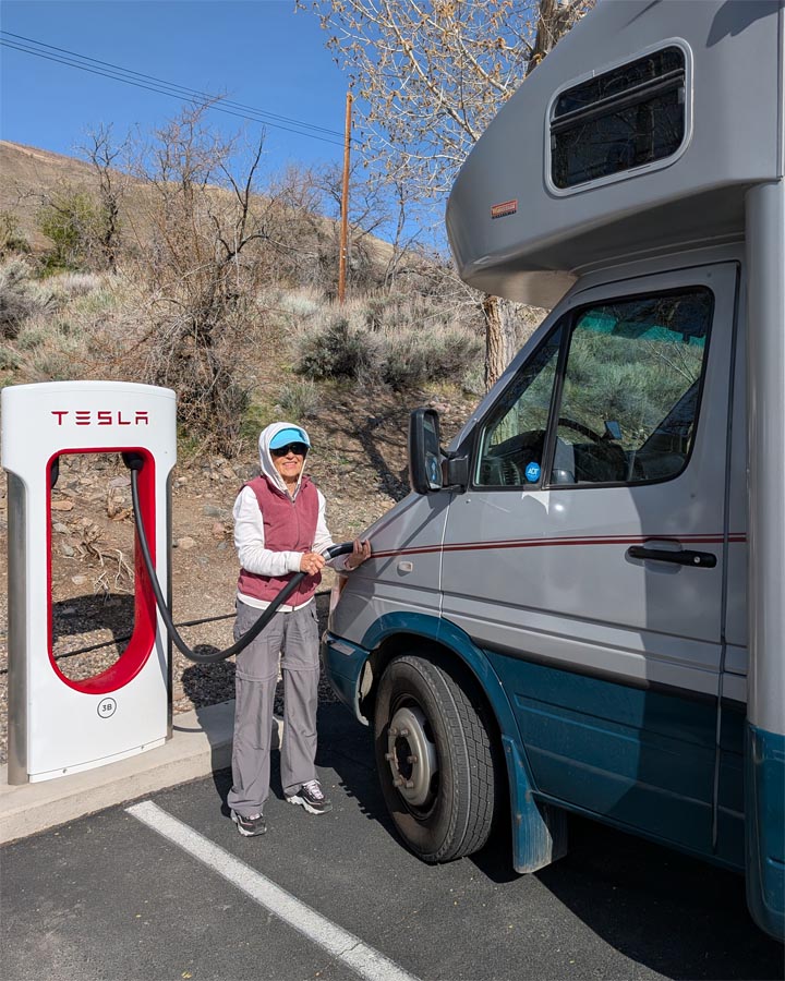
| Day 9 It got down to the mid 30's outside and our little electric heater had a hard time getting it up to temperature in the morning. Our destination was home via the most direct route which was Hwy 50. As they were gouging on fuel prices here in Lee Vining asking almost $7 per gallon we only put in enough to make it to Nevada where the asking price was around $.350. The ride home was uneventful. Long but scenic for the most part. Luckily we weren't going though Sacramento during rush, but it was still heavy. Overall a great vacation in spite of visiting a few of the same places. |
 |
|
| We just needed a little bit to make it to Nevada. |