| We really had
planned on going to Scotland and the Hebrides this spring, but
once the realities of 15 hour flight wearing a Covid mask among
other problems hit, we changed our minds. As the coast was out
due to booked camping spots and the sierra's and northern states
were out due to rain and snow, we headed for the deserts again.
Not only would it be drier, but if lucky, we would be there
during the peak of wildflower season, and if really lucky
perhaps even a super-bloom. Well - it was kind of hit and miss. |
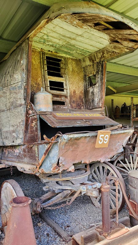
San Benito Historical Park. One of the
many interesting exhibits there.
|
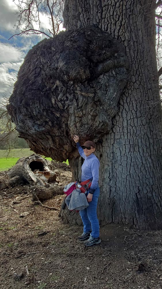 One of the largest galls we've ever seen on an oak. |
|
Day 1. Our ultimate
destination was the southern California deserts and some
trails and areas we had missed on previous trips. Determined
not to have marathon driving days this time, our first stop
was the Pinnacles, about three hours south of us. On a lark
we stopped at the San Benito Historical Park just below Tres
Pinos. We didn't expect much other than a lunch spot and leg
stretcher. But we were pleasantly surprised at this quaint
stop housing a rustic collection of farm equipment, old
buildings, a small museum and a nice large picnic area.
Since we had hiked most of Pinnacles trails and many were
closed, some sadly to vandalism, we headed North East out of
the campground towards the Butterfield Ranch. Unfortunately
a semi wild very possessive horse disputed our right to pass
HIS grazing area so we reluctantly turned around and
bushwhacked our way back to the campground.
|
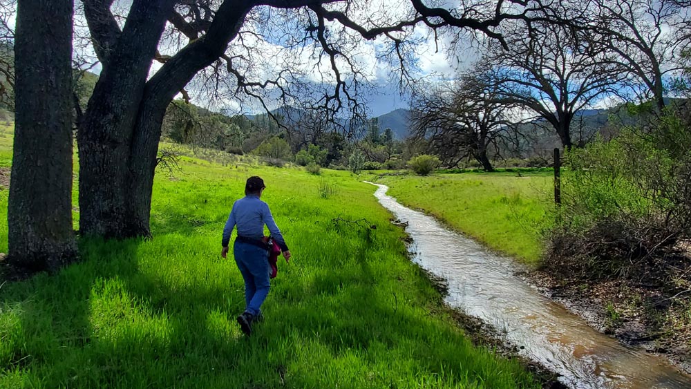 Bushwacking in Pinnacles Park.: |
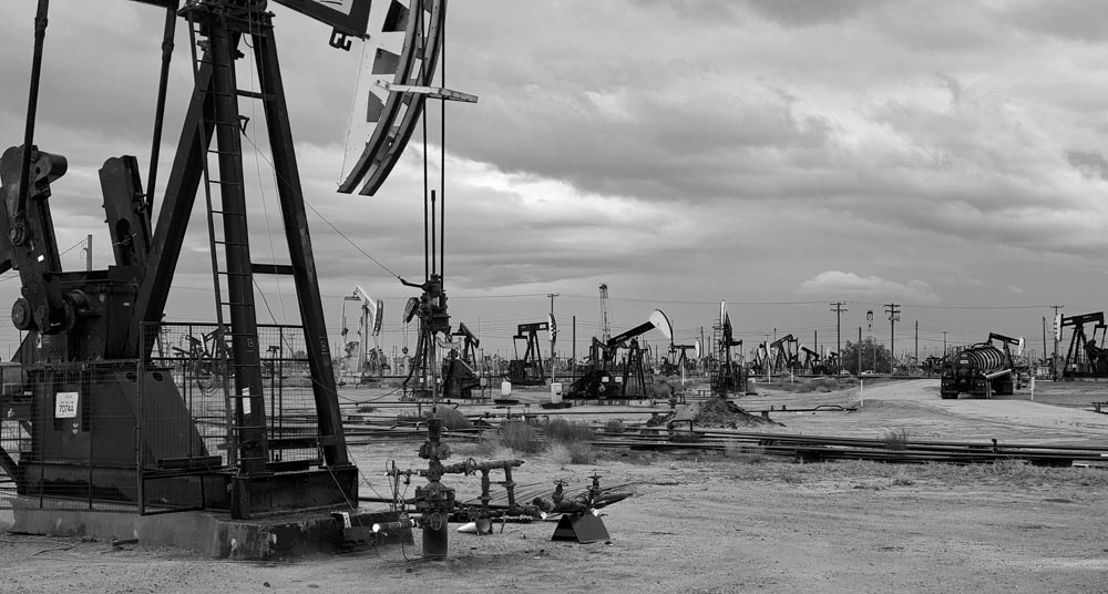
I'm sure the owners of these oil rigs
think they're beautiful.
Day 2. In view of the
horrendously bad weather predicted Tuesday, and much of our
next destination having dirt roads with low lying camping
spots, we opted for the Red Rock Canyon instead as it was
further inland and south plus better protected. Hwy 25 to
King City was beautiful and green but had lots of erosion
along it's banks. Fortunately most of it was minor and kept
under control. The highway to Bakersfield wasn't worth
mentioning but the fields were blooming as were the oil
fields derricks as we got close. Ms. Garmin (as we refer to
our GPS) does a great job for the most part, but she has
some failings. Mostly not being up on the latest closures
and interrupting us during an important conversation instead
of waiting for a lull. Luckily I'm not above asking for
directions and a local gave us a quick alternate route when
Cal Trans closed one of the major on-ramps due to
construction. Near the top of the Tehachapies we got a bit
of a shock seeing derailed train cars on the side of the
freeway as if it just happened. It was only weeks later we
found it had happened two months ago and was still in the
process of being cleaned up. Red Rock had several open
campsites left and somehow we got one designated for
handicapped but just now available to all being complete
with level concrete pad, cover and barbecue pits. Other
campers looked at us a little askance as we hopped and
jumped around our campsite setting up. After that we had an
amazing hike around the grounds even though the weather was
a little iffy.
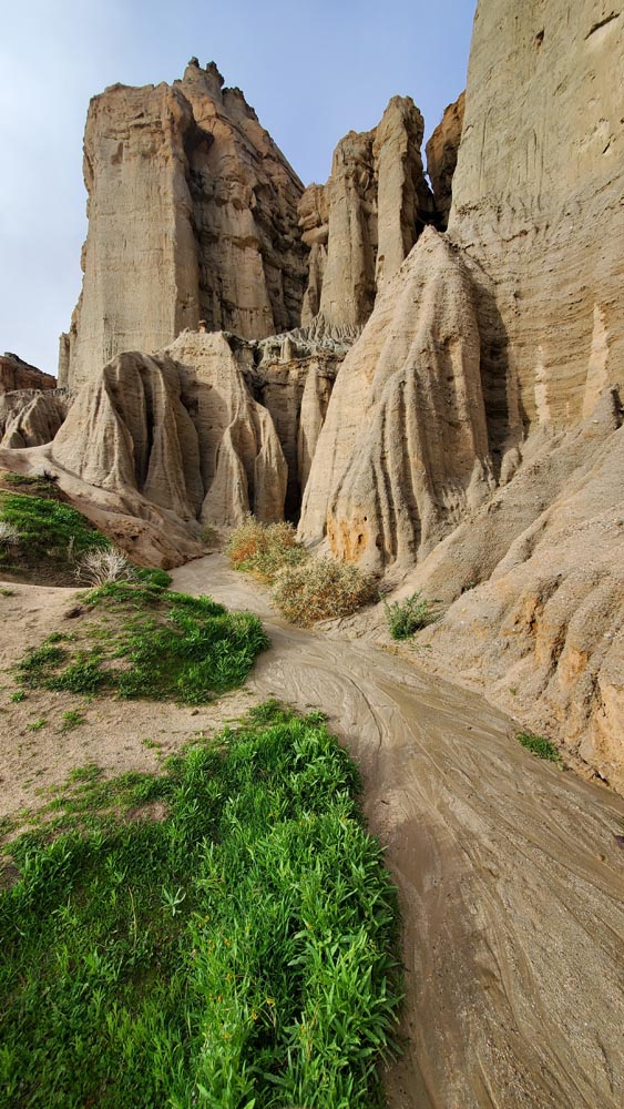
Part of the cliffs surrounding the Red Rock Canyon
campground.
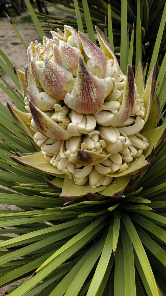
This Joshua Tree bloom was almost a foot high!
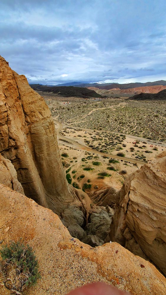
A view of the RR Campground from
the cliffs.
| Day 3. Our last day of driving had now put us in a closer position to our next destinations, the Antelope Wildflower Preserves and then Saddleback Park about 15 miles west of it. After another morning hike around our park we headed to Antelope via a lot of small detours over rough roads and through sporadic rain. When we finally got there they had erected a gate and now charged $10 for parking on what would have been a soggy hike through a wet field with very few flowers. Instead we parked by the side of the road for free which had more flowers and ate lunch. As we were early for Saddlback we took a very nice little mile trail out of the visitors center and then settled into our campground. After dressing up for a hike two dogs befriended us which I thought was nice until they refused to leave our side the whole way. We later found they were 'homeless' from a caring lady who fed them occasionally. |
.jpg) The San Gabriel Mountains looking south from Saddleback Park. |
| Day 4. After a leisurely breakfast and plenty of coffee we had built up enough courage to tackle the L.A. freeway system. Our destination was the California Botanical Garden in Rancho Cucamonga. What an amazing place! There must have been over 100 acres of manicured desert plants in some creative lush settings surrounded by wandering paths. We spent several fascinating hours there. On to Tom's place, Mimi's brother. While the botanical gardens were a desert paradise, Tom's place was a tropical jungle complete with bananas, avocados, citrus fruits etc. from which we made us an amazing meal. |
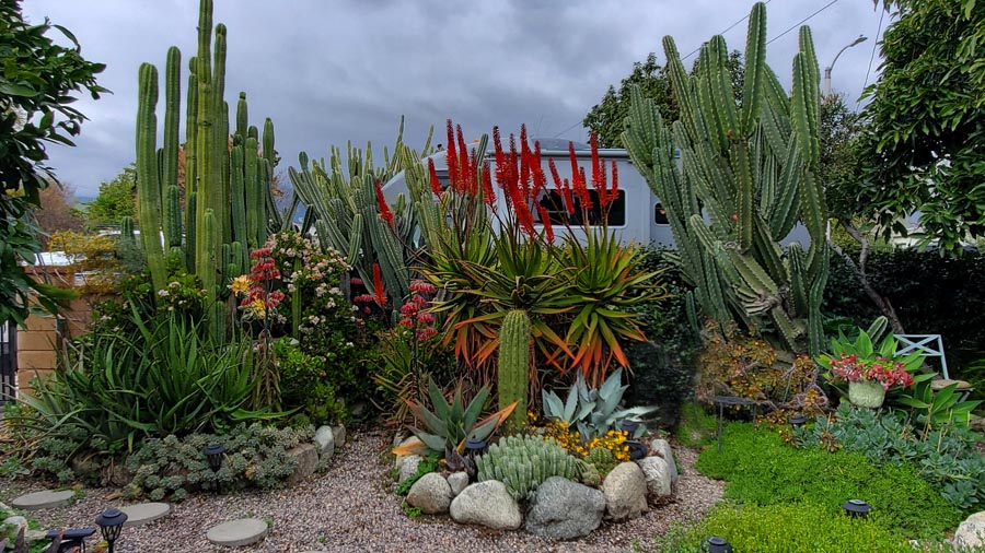 Tom's place. |
| Day 5. On our fifth day we headed for Anza Borrego with a few set backs. Unfortunately we didn't have enough fuel for that large remote desert area as diesel stations were nearly non existent. Plus the two sights I had listed weren't worth the stop. I think on one of them our steps somehow hit and got jammed and wouldn't extend which was a pain but wouldn't cancel our trip. By early afternoon we made it to our dispersed Blair campground. It was nice and the price was right - free. We we took an interesting hike around the level grounds and then over one of the low passes which had more vegetation before settling in. After carefully considering distances and fuel reserves, we decided not to risk going further south but made plans to head back up north closer to Borrego Springs as the town had a lot of attractions as well as diesel fuel. |
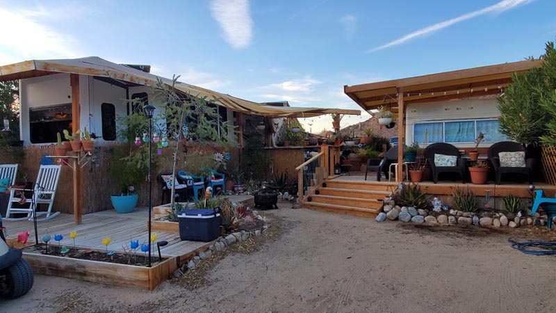 Camp Hosts at the 20 Palms RV Park do it right with their trailers. |
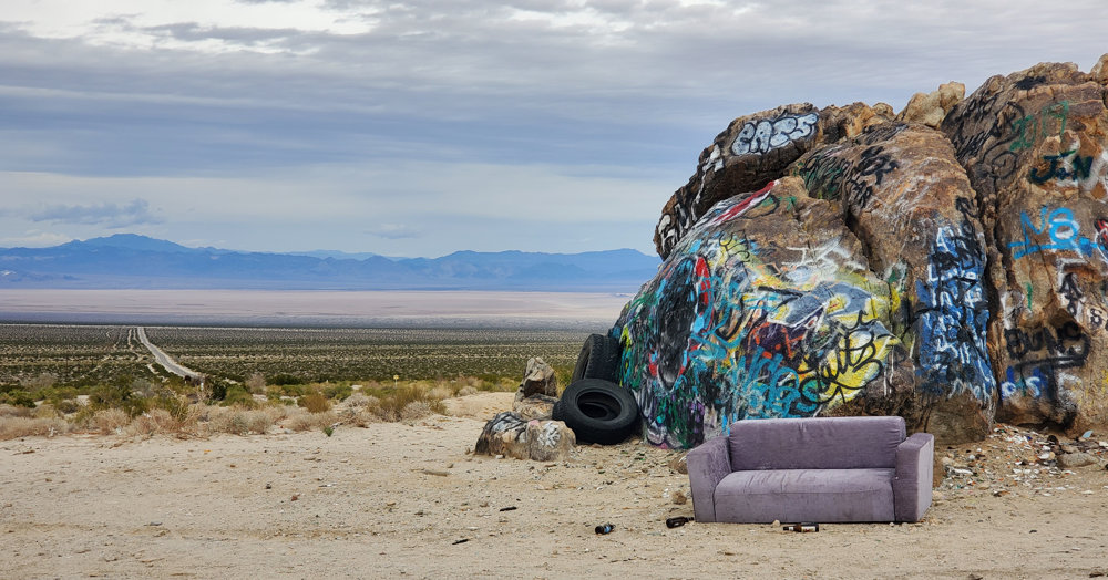 No, this isn't the 'Painted Desert', but some vandals think otherwise. A view of the Mojave basin on the left. |
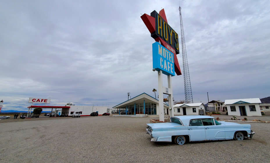 Amboy. Probably much as it appeared in the 60's. |
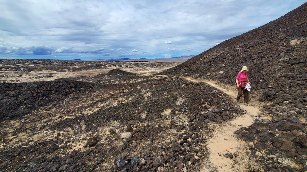 Scaling Amboy Crater. Mostly climbed because it's there. |
|
Day 8. I heard a loud boom and felt the camper shake while
in the shower. To this day I'm not sure what happened as I
could find no damage or anything wrong. My best guess is a
large bird hit one of our two big windows. Onto 'downtown' 29 Palms for some groceries and fuel. Prices were good and the town was mostly clean. I think they are attempting to clean it up to attract more tourists as it seems to have a manicured 'funky' feel. We had a hike planned on the way to Amboy, but it was hard to find and the area was scenically challenged. The old town of Amboy on Route 66 is a kick having been arrested in the 60's. They appear to be renovating their old hotel which must have been a Mecca for travelers during it's time. On to the Amboy Crater a few miles down the road. We hitched up our packs and headed off to the crater a little over a mile away. It's a three mile hike round trip hike to the top of the crater through barren volcanic desert landscaping interspersed with sand but little vegetation. Still we enjoyed this unique austere hike to the top. The overflow parking lot we were in wasn't marked as a campground except in some obscure BLM documents, but we had about a half dozen campers here and it felt like a friendly little community. We talked with one interesting couple until it got too dark to see each other. |
 There is a trail completely around the top, but parts of it have a knife edge. |
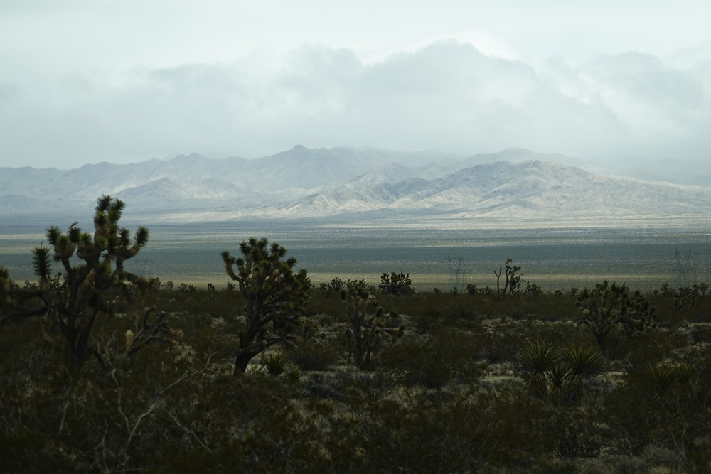 The Mojave under siege. |
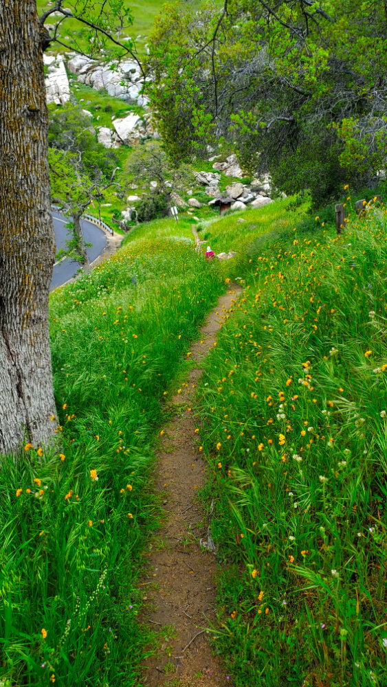
| Day 11. On this our last day we
parked at a very small spot on the side of the road at an
awkward angle so we could take the Buzzards Roost Trail I
had read about. I imagine in summer it would be a nice hike
but on this spring day after some rains it was stunning with
the tall green grasses, wildflowers and views of the lake.
It was about 3 hours home, and aside from some crazy drivers
in traffic (as usual) and Ms. Garmin trying to show us the
scenic route, we had no problems and arrived home about 1 or
so. As usual we seem frantic about unpacking and in an hour
we were done. But we always find something the next day we
forgot. It was a great trip over all... not counting that
one day.
NOTES:
|
|
|
