| It's getting more and more
difficult to find new things within 1000 miles of our home in
the Bay Area. We have seen most of the grand natural wonders the
west has to offer, but there are quite a few little pockets of
interest left yet, but they are harder to dig out. As the
deserts are often too hot to visit in mid May, and we had just
been there, we opted for southeast Oregon. For one, spring was
in full bloom in that area and second, it wasn't exactly a
tourist destination which would give us our choice of
campgrounds. We only felt we had to make one reservation, and
that was close to Reno where things were just starting to get
busy. |
 Rosewood Nature Study Area |
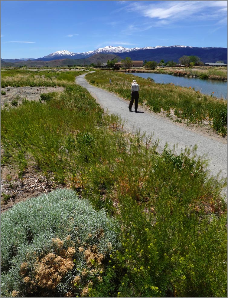
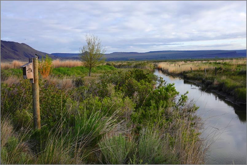
 Rye Patch reservoir in Nevada at about 1/3 down Our first stop was the Rosewood Nature Study Area about 5 miles southeast of Reno. It started life as a golf course which the Truckee Meadow Parks Foundation turned into a native habitat for wetland plants and animals. While a little rough still, it had a lot of bird life and great views of the surrounding snow capped Sierras. |
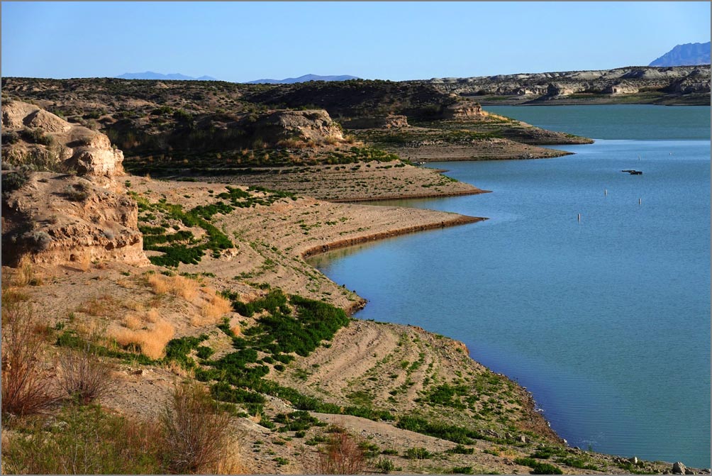
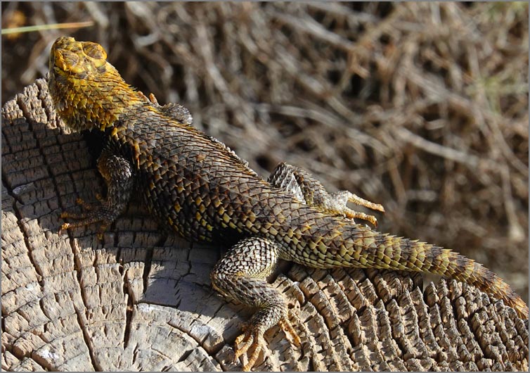 Probably a Western Fence Lizard We were determined not to have this be a driving vacation so made our first camping night at Rye Patch, a giant reservoir about 100 miles northeast of Reno. It's cheap, interesting and seldom full. Plus there is overflow for free in a pinch - our kind of place. After securing a spot we took a short hike and then settled in for the night which often entails me grilling something with perhaps a short walk afterwards and then a movie or reading after that. |
 Our camping spot at Rye Patch |
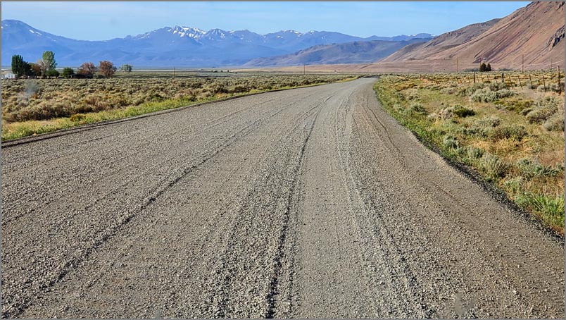 Part of the 60 miles of gravel road near Alvord with the Steens in the background. |
Day 2: It was perfect weather in the mid 60's so we opted for the neat little reservoir hike they had between the two campgrounds. What amazed us is how low the water was. Somehow we hoped Nevada had escaped our dry weather, but unfortunately not. From here we headed for Paradise Nevada, a small semi ghost town started in the mid 1800's when settlers first explored this area. Apparently one visitor saw the green fields and thought this area would be a paradise for farming hence the name. He must have come in spring. |
| On to the great dry Alvord lake bed in southeast Oregon by the Steens Mountains. I have to admit highway 140 to Denio wasn't too exciting, but still a pleasant drive though barren desert landscape and occasional ranches. |
| About 8 miles from Alvord we got an unpleasant surprise - dirt road. Somehow I thought this would have been paved after 100 years of use, but apparently not. As we had no alternatives we gritted our teeth (so they wouldn't fall out) and continued on washboard roads at an 8 mph clip to our destination. But it was worth it as we got a nice free campsite by an amazing flat lake bed to wander around on for about an hour before turning in for the evening. We had planned to camp right on the lake bed which would have made for some interesting photos, but there was one little section that I didn't trust our camper to get over safely. We planned on heading north the next day but weren't sure of road conditions nor the availability of diesel. On asking one of the locals |
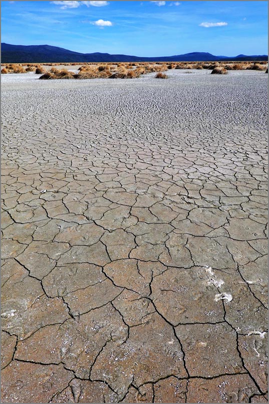
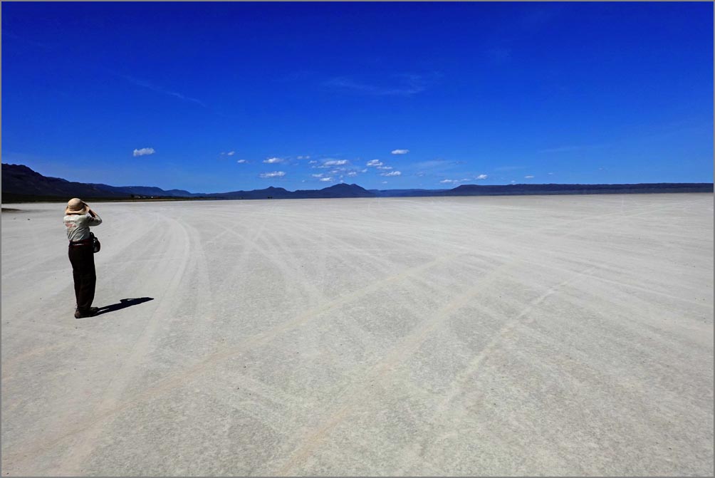 The 5 by 15 mile dry Alvord lake bed. "Do I see water?" |
| he said with a straight face that it was dirt heading north but only 50 miles of it. Somehow to our amazement we got cell service out here and started planning alternatives as there was no way we were going to go 50 miles at 8 mph. Luckily Frenchglen, a small village on the other side of the Steens Mountains, had diesel and looked interesting. Plus it would only be a 20 or so mile detour, but on paved road. |
 |
The next morning we backtracked
on the gravel road and after kissing the pavement headed
west and then north on the fairly scenic Hwy 205 to
Frenchglen, a quaint town with it's old hotel being the
center of activity here. It did have a very nice large
Malheur Wildlife Refuse which looked interesting for a
possible return visit with our FJ Cruiser. The hotel had an
old pump without a credit slot and the owner was very
relaxed, as was the whole town. He said "Just fill it up and
tell me how much you got". I did and he took my word for it.
|
|
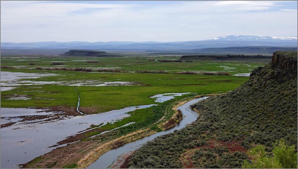
Buena Vista overlooking part of the
Malheur Wildlife Refuse As we were looking for things to do on the way out we spotted the Buena Vista Butte just a mile out of our way. It had an amazing view from the top of the hill - unfortunately on a narrow dirt road, but fortunately only a half mile long. |
|
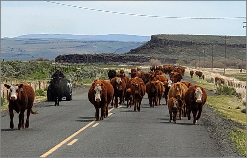
As soon as we got on Lava Bed Road we were greeted my a few cows crossing the road, or so it seemed. But as we turned the corner to get on the main road, there were hundreds if not a thousand that stretched about two miles. We had never encountered so many animals on a road ever. And one bull thought our side of the road was his also. Luckily we were a little bigger. |
 |
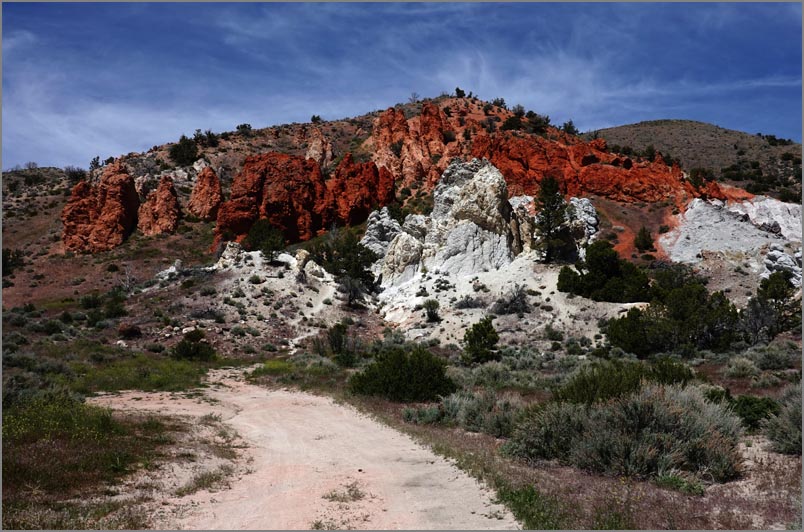
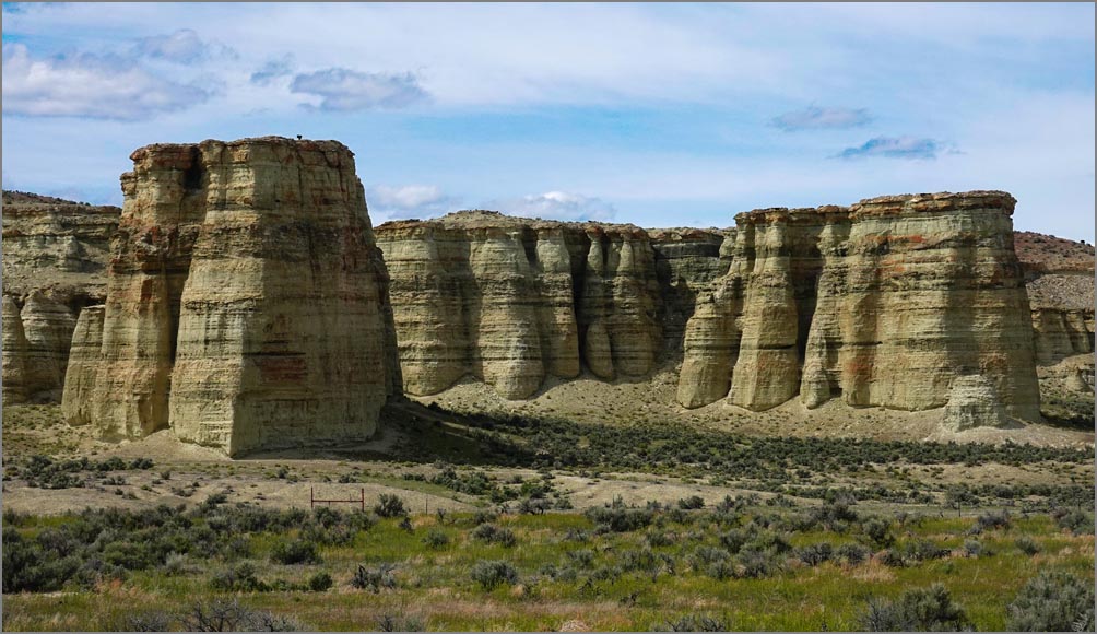 Pillars of Rome near the town of the same name |
We were suppose to camp at Solcum
campground in the Owyhee wilderness this evening, but
suspiciously we looked closer and realized it was again on
dirt road - 16 miles of it. We've never met a dirt road
which didn't have some washboards, and we've never been able
to exceed about 10 mph on washboards without ripping things
apart, so that was out unfortunately. Cars seem to have far
fewer problems but even then most sane drivers will limit
their speed to about 30 mph, but I think that's because of
tire pressure. Ours are almost 60 pounds and most cars run
around 30.
|
| I always plan alternative sites
to see and campgrounds to stay at in case things go wrong,
and the Pillars of Rome was one alternative we had noted. It
was also getting late and we also were concerned about a
campground. Thankfully our Benchmark maps came though again
and showed a small river launching place which also had a
few camping spots just a few miles from the Pillars. We
pulled in expecting the worst but found a lush clean river
campground with a half dozen spots only one of which was
taken. Best of all it was completely free. We claimed our
spot and then drove to the Pillars looking at farmsteads on
the way, and then over an old bridge for photos before
returning for a pleasant evening while watching the sun set
over the Owyhee River not 20 feet away. The following day just east of Marsing we climbed a local promontory called Lizard Butte while fighting blustery winds for a view of the country side. Then onto Lake Lowell where they had a charming little museum set in a nature preserve where we enjoyed some hiking. By then it was time to see an old friend of Mimi's who had just settled into a newly built house with her new (to us) husband for a catch up evening and some of the best deep fried crappie we've ever had (not being a fisherman I wasn't even sure they were even eatable). Not only did we get a great meal but as fellow RV'ers they had a complete hookup for us, even under cover! |
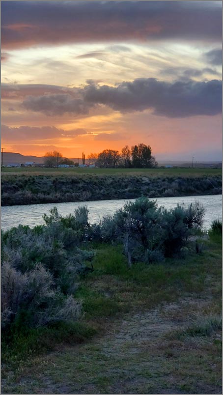 Owyhee River & farmlands beyond. |
 |
|
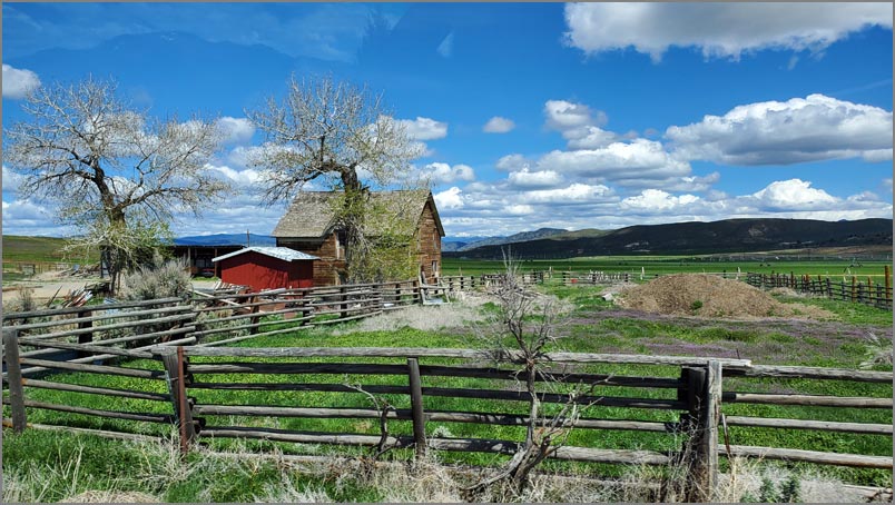
| Typical outback Oregon farmstead. On day 5 we headed north though some rural towns like Homedale, which could have been a setting for the Last Picture Show movie, before heading west on Hwy 26. This road was quite scenic passing though fertile plains and then up into forested hills. We usually try to stop regularly before our legs lock up permanently from sitting. Our first stop was a woodsy walk at the Sumpter Valley Interpretive Trail along an old track bed which was a testament to all the railroad logging activity from years past in this area. Then onto the Dewitt Museum in Prairie City, a nice little display of historical artifacts from the pioneer days. We love these little museums where for a few dollars you get an hours worth of entertainment as well as an education. Back on the road again for an hours drive to the John Day Fossil Beds and the Thomas Condon Paleontology Center. We were there years ago but they had added another interesting section well worth exploring. After that we took a quick hike up the hill right out of the museum and then on to our Lands Inn camping spot. |
| |
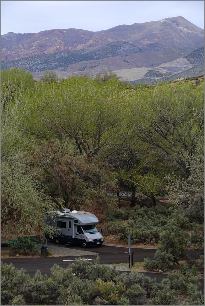
 Lands Inn and his 2000' grass runway. Make sure you have extra big tires though. On getting to our turn off we found to our horror it was up another narrow 5 mile dirt road into the mountains! We contemplated trying to find another place but as there were few options, we resigned ourselves to another horrible set of washboards. Well, it had very few washboards to our surprise, and we managed almost 20 mph most of the time. Unfortunately there was a locked gate at the end and no sign of anyone. As we were about to turn around someone came up and said they showed no reservation for us. We were flummoxed at that point but the owner finally said he'd make room for us. It was one of the most amazing campgrounds we had ever been to. He was a pilot and had his own 2000 foot runway right out of the campground which had an almost alpine like setting. He also brought in an old hanger which had seen notables like Amelia Erhard and Charles Lindbergh among others. After wandering around a bit we retired for the evening on our grassy pad. |
 The Blue Basin Lower trail at the Sheep rock unit. |
|
The following day we headed back
to John Day for some local hikes before heading south to Sun
River to visit some other dear friends for another wonderful
evening of friendship and great food not to mention some
fairly good beers to boot.
|
 A wider section of Crack-in-the-Ground
|
|
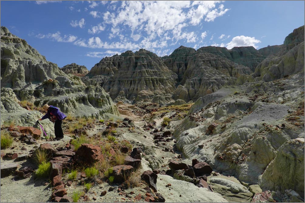
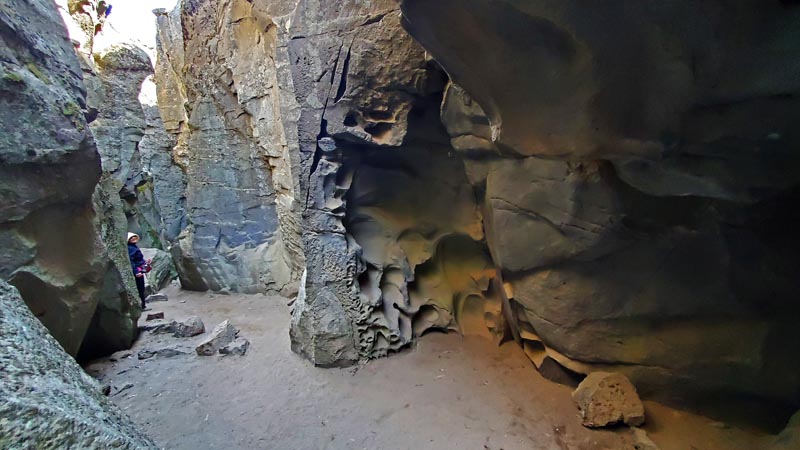
| Day 7 had us heading for the Crack-in-the-Ground. But as we were a little early we opted to take in Fort Rock again, an old volcano remnant which rose up through the mud flats during the ice ages. Being almost a mile across it makes for an interesting little hike and wonderful almost surrealistic views of the surrounding landscape. And as usual, Mimi kept a sharp lookout for new and interesting wildflowers. Unfortunately Crack-in-the-ground was up another 7 or so miles of dirt road, but we knew this and resigned ourselves to our usual slow crawl. Luckily we found a shortcut which shaved off a few miles. From the parking lot it was a quarter mile hike across a high desert juniper landscape to one of the most amazing formations we had seen recently. More slot like than canyon, it ranged from ground level to about 30 feet deep in places while mostly only about five to seven feet wide |
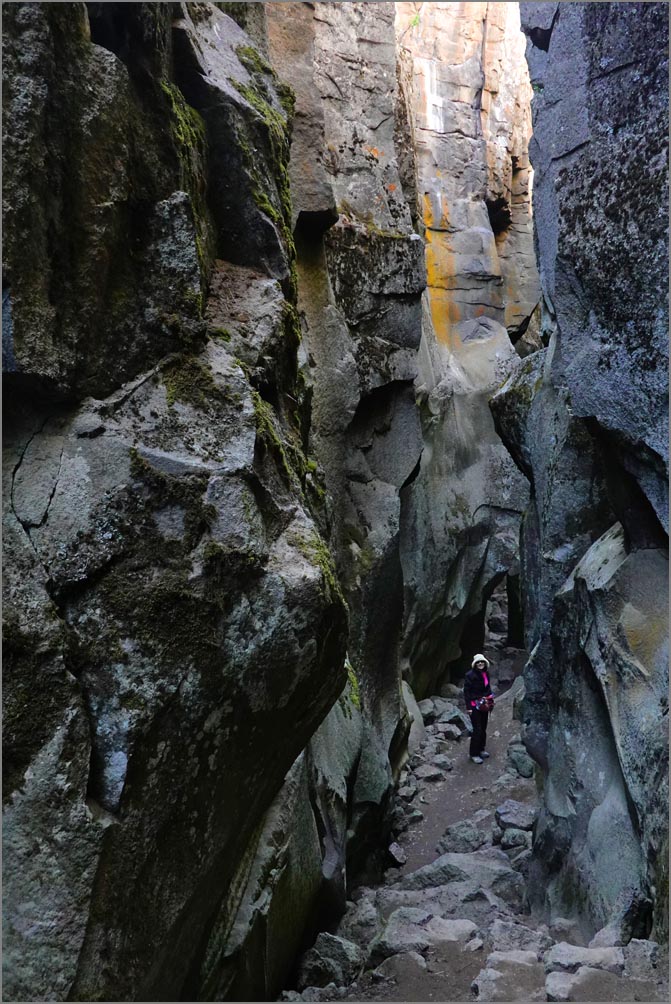 In the depths of Crack-in-the-Ground. |
 Summer Campground |
After lunch it was back on the
road again to our Summer BLM campground on the norther part
of Summer Lake. This was another great free campground among
amazing swampy riparian landscaping full of wild life.
|
 Eagle Lake's northern section |
In the morning we took a nice
walk around before continuing south. We topped up our tank
at a local town as this was our last chance for cheap gas
before California. Our first stop was at the Bullard Canyon
trail which Alltrails gave good ratings to. Well, it had
some nice views on a very steep somewhat scrubby climb, but
the best part of the trail was the friendly person on the
way up. Back on the road again for the long drive to Eagle
Lake which had a number of good campgrounds on it's shores.
Shores which were now about a half mile away from the
campgrounds. The one we came to was North Eagle Lake CG. We
stopped in for a quick look and Mimi immediately said that
this was the one as it was so nice. There were only 2 other
campers in this woodsy scenic campground and they charged us
a grand total of $4 with our Golden Age card! As there were
no official trails, and we had some time yet, we took off
towards the lake as best we could. We didn't want to hop a
fence, but did find an official hikers entrance after a bit
(long covered with shrubs) and continued on a half mile trek
to the lake over ever softer soil. Finally it felt so spongy
our feet started to sink in so we took a few pictures and
returned 'home' for a nice barbecue and brew with a movie
afterwards.
|
 Our $4 campground, It's a hard life. |
 Susanville Ranch Park & the amazing meadow & woods trail. |
On Tuesday we took off for Susanville down scenic 139. Roops Fort was a bit disappointing as the wonderfully built historic cabins were mostly neglected & starting to decay. Then onto the Railroad Museum, which was unfortunately closed due to lack of volunteers. As there was only one more thing for us to do here, we put on our hiking boots and headed out of the Bizz Johnson railroad trail, which was very nice as it went along the old tracks that ran though some lush forested areas before encountering some amazing cliff rock formations Olmec stone builders would be proud of. We had one more hike in this area and that was the relatively new Susanville Ranch Park developed out of an old ranch and saved from development. Well, that wound up to be one of the most beautiful hikes we've taken to date, a perfect combination of mature woods and verdant pastures. It's one of those places you'd want to build a home in...at least we would. Our last hike of the day was Red Rock Trail off of Hwy 395. On the way we ran into a horrible construction zone with a half hour wait. Then the trailhead was so rough we had to park on the side of the road. And lastly while the rocks look interesting in a photo, in real life they look almost painted or unreal due to their out of context bright almost shocking colors. On to our Bordertown RV park. This one was $55 per night but we had full hookup, a nice concrete pad with mowed grass surrounding it and our own casino - for those into that sort of thing. But it was the only park for miles around and we could use a good cleanup. |
 Red Rock Trail
|
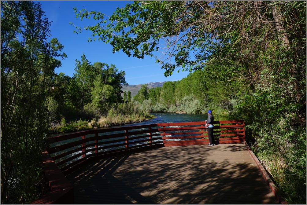 Oxbow Park close to Reno. A bit of calm in the bustle.
|
| The second to last day had us take in two nice parks
along the Truckee River wisely protected from development by
concerned locals. And another construction laced ride to
Grass Valley. When planning the trip a worker said the
fairgrounds there had plenty of space and there shouldn't be
a problem getting a space this time of year. Well it was a
traffic jam there and not one empty space due to the
Strawberry Festival. But one of the gate people said we
could join the festival and hope for a spot for only $400.
We declined and found another RV park which was in a
forested setting and actually had some hiking trails on it's
ample wooded grounds. Our last day was a ride to the best campground yet, our home in Green Valley. We expected the worst going through Sacramento during morning rush, but encountered no problems. Great trip overall. And as we often say: "Good to go and good to come back". |