|
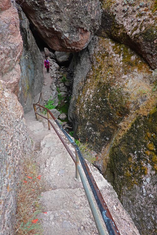
Day 1. Well, we can't seem to get enough of the southwest deserts. This time we hoped for cooler weather. At least that's what the yearly averages said. By November daily highs are suppose to be in the 70's for most areas, but you can also expect freezing temperatures at higher elevations at night. We got invited to Mimi's brothers place again... with a bit of hinting. This time we wanted to avoid the 10 hour drive so managed to reserve a spot at Pinnacles which would knock off about 4 hours of driving from the north bay area. As it was mid afternoon when we got there, we didn't want to sit around so chose the Moses Spring Trail to the Bear Gulch Reservoir, a fairly short easy hike but has a nice sampling of what the area has to offer. |
 |
|
| The only trail down from Bear Gulch Reservoir |
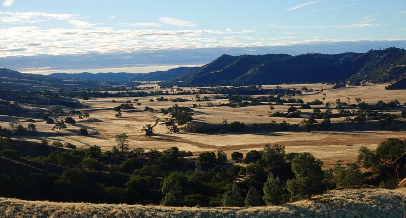 View from Hwy 198 heading towards Hwy 5. |
|
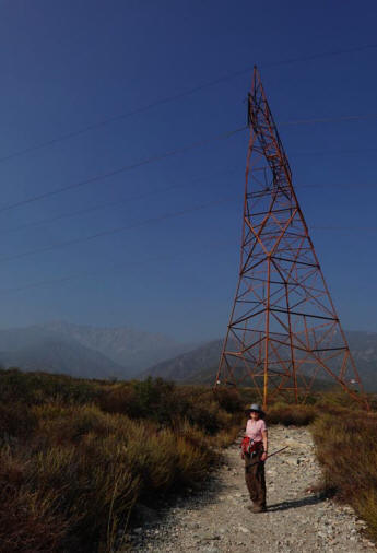
Day 2. We got an early start the next day as the idea was to get onto Hwy 210 towards Rancho Cucamonga before 1pm, the deadline for avoiding heavy LA traffic. We enjoyed the ride down 25 and then 198 to Hwy 5 except for one part where a farmer had parked his pickup right in the middle of the road with no sign of wanting to move. Well after a bit we saw why. A cow had gotten loose and was heading down the road towards Southern California at top speed. It should have planned it's escape under cover of darkness. After a long grind on Hwy 5 we managed to get there just on time and avoided all but a few slowdowns. Being a little early we set the Garmin to the Etiwanata Falls Park just a few miles from our destination and listed as a good hike by Alltrails. On getting there we found they wanted payment for parking, but only used QR Codes. This was new to us but luckily had loaded a reader only days before and had gotten my phone to do data at the same time. I tried the reader and it worked! A small advance in technology for old people. While it wasn't a world class hike, everything was clean, there was a lot of vegetation and the temperatures were perfect, so we really enjoyed the hike. After that we parked at Tom's place and got treated to one of his amazing home grown meals of tropical fruit he grows in his back yard. He even has bananas. |
 |
|
| Etiwanata Falls Park on the southern flank of the Mt Antonio |
|
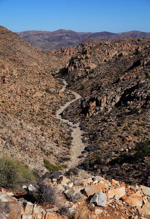
Day 3. The following day we headed for Joshua Tree that we were lucky to get a reservation at. We had planned on a few hikes but the main one didn't allow RV's so headed for one of our alternates which unfortunately was a mile down a dirt road. This was the Prairie City area with a lot of good hikes. We took the Desert Queen Mines Trail and then followed that up with a pleasant walk north on the Pine City Trail for a bit. By that time the sun was getting low and it was time to head for the campground for a relaxing evening. Day 4. |
 |
|
| Part of the Desert Queen Mine trail. |
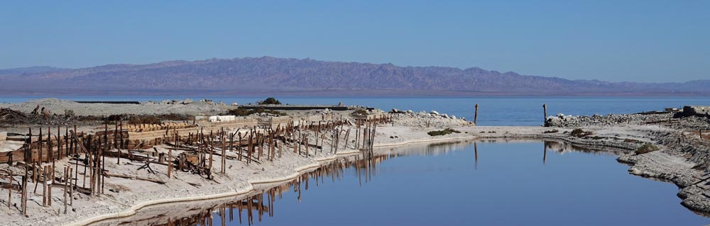 The dried up Marina at Desert Shores which developers had poured millions into. |
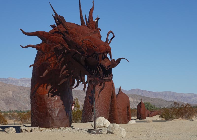 One of the many Galleta Meadown sculptures. This one is about 700 feet long. |
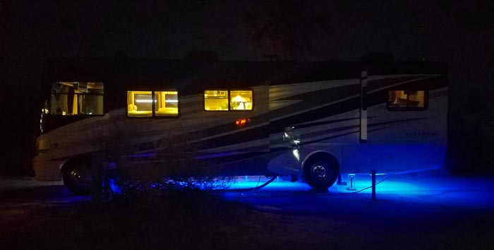 Some of the fancy rigs seen at the Anza Borrego Campground. |
|
| Day 5. It took a while but we were able to secure another night at this campground as temperatures were due to soar again. Then we took a long drive down Hwy S2 to Agua Caliente which had two more hikes. but we only did one of them due to heat. This is one of the rare times it was too hot inside our camper to eat lunch so we actually turned on the generator to run the air conditioner. We tried hard not to feel guilty while enjoying the cool air. Back to Anza Borrego but this time our hikes were inside the air conditioned museums in town and the visitors center before it cooled enough to go outside for another short garden hike. As we entered the campground we saw water gushing from one of the mains, and on hooking up our water we got no pressure, but others did, even though it was weak. I finally figured out that they had no pressure reducer on their camper water lines and we did. As soon as I removed it our flow was fine... well good enough.
|
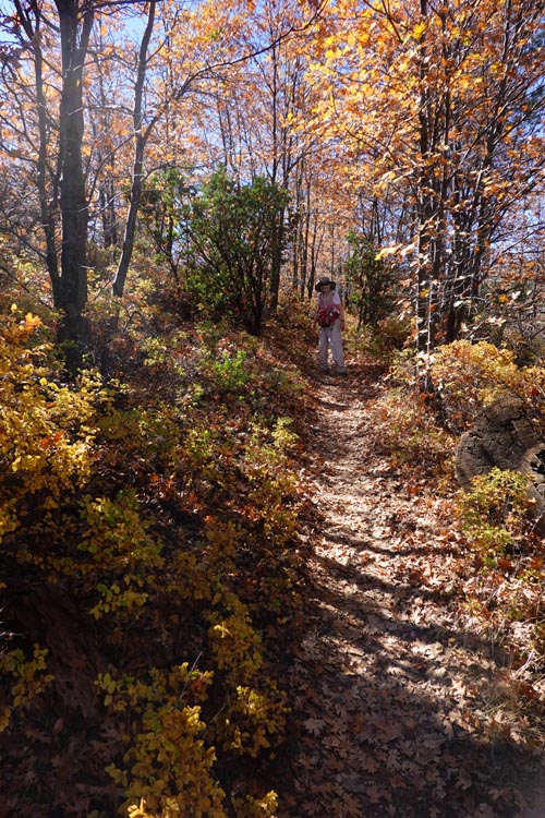 |
Day 6. Cuyamaca was a new park to us, and the ride from Anza Borrego's 600 feet to Lake Cuyamaca's 4600' saw the landscape transform from desert cactus to high desert junipers and finally pine and deciduous forests. We went though a few busy but charming little towns when we discovered that this was apparently a tourist destination from the San Diego metro area. Our first hike was the Marty Minshall Trail which follows the shores of Lake Cuyamaca on the south side, and what a wonderful trail it was. We never expected to see New England fall colors but this trail had them in abundance. We tried a few other trails but had one problem after another, mostly due to crowds which we were anxious to avoid, but that was to be expected on a weekend. So we headed to our Oakzanita campground early as there was a hike next to it and we could simply walk. This campground had high ratings and wasn't cheap, but on coming to the gate we were grilled for identification, insurance, etc. which had never happened to us before. Plus looking around all the buildings, and facilities were of the cheapest materials and often unfinished or needing repairs. The gate guard was friendly though and he gave us a list of places to choose from. As we wound up the narrow badly paved roads, most all the spots were small steep raw earth pads that looked to be just bulldozed out of the hillside. We settled in and then took the local trail which was marginally nice. Our next campground was on cheap undeveloped BLM land and after this I was looking forward to it. | |
| Marty Minshall Trail on the south shore of Lake Cuyamaca |
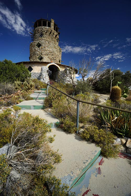 |
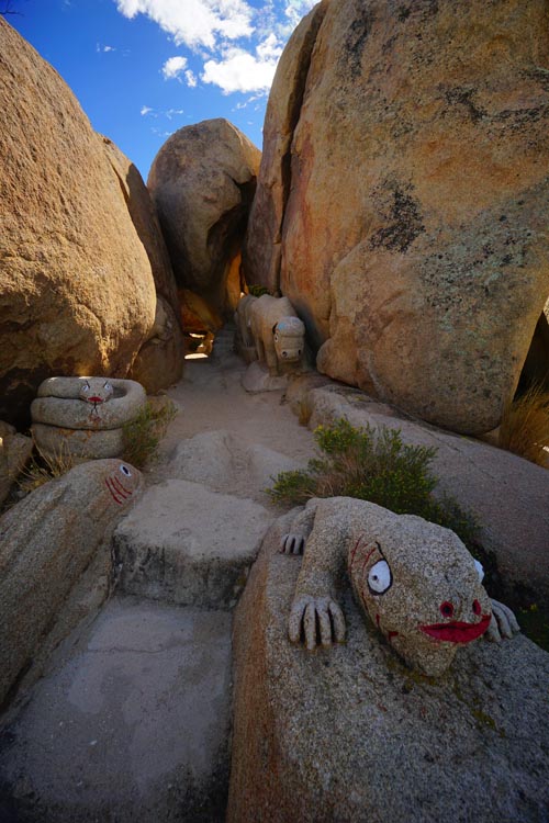
Day 7. Woke up to a temperature of 41 degrees outside. Over 20 degrees cooler than the last few days. This day we headed for Blythe along the lower Colorado River. Another area we hadn't seen. We tried a hike that looked good, but mostly followed a fire road up into the hills at a 45 degree angle, and didn't look too interesting. The weather people said this was to be a warm day as we were crossing the central valley, so it was a good day to have scheduled inside visits to some museums. Our first destination was the Desert View Tower near the lowest dip of Hwy 8. On the way we to the Desert Tower we passed Coyote's Flying Saucer Retrieval & Repair Service. I'm not sure if the Plexiglas domes set on old upside down satellite antennas would fix my flying saucer if I crashed landed here. The Desert Tower was a piece of Eden though. It was set in a sandy oasis among giant rocks and interspersed with a few charming little houses that look like they had grown here. They asked for a small admission, but it was well worth talking to the friendly owners and viewing all the eclectic junktiques. There were several floors to the tower, each with it's own unique collection of nick knacks, and the rustic climb was like going up in an old attic. Afterwards we went outside to the small cave like hike set among giant boulders adorned with strange creatures. Fun. Then on to the newly built and modern Imperial Desert Museum which housed mostly Indian artifacts. Nice for a quick stop. Next was the large Pioneer Museum in Imperial City. They had an amazing collection of stuff on two floors from table spoons to tanks. The whole museum and many of the displays seemed to be arrested in the 1950's which made us feel like time travelers. We climbed back into our camper and headed through miles and miles of straight farmed lines country roads until it slowly gave way to a dryer and dryer countryside as massive dunes in the distance slowly grew in size. |
|
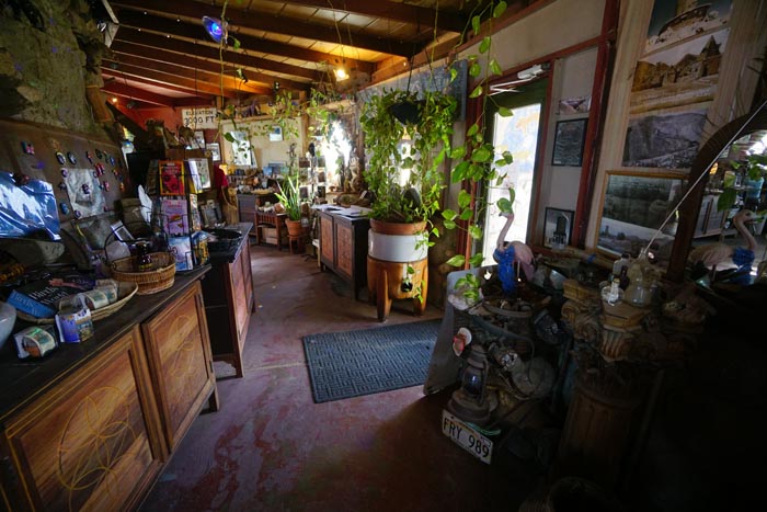 The bottom floor of the Desert Tower. |
 |
|
|
We were coming to the Algodones Dunes Wilderness, playground
for ATV's and dune buggies. We had just enough time to stop
at the Hugh Osborn Lookout park set near it's center to
overlook giant sand hills stretching to the horizon. If you
are looking for pristine wilderness this isn't the place as
every hill is crisscrossed with tracks of rumbling
machinery. We hear the northern part is more desolate and
hiker friendly and will perhaps go there someday.
Unfortunately our Garmin misjudged the distance to our next
stop (couldn't be our mistake) and we rushed to get a spot
before the quickly setting sun hit the trees. We finally saw
the problem. Ms. Garmin didn't recognize the dirt road
(strange as she tried to send us down many in the past) and
sent us dozens of miles out of our way in an effort to stay
on pavement as much as possible. I finally had to resort to
the cell phone maps to find the right road. As we cautiously
approached our turn off, we saw only three small dirt farm
roads and chose the biggest. We appeared to be going in the
right direction and on the right dirt road but could see
nothing but a few trees a mile down with no sign of a
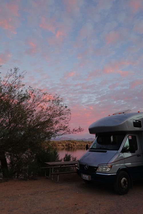
campground. At the last few hundred feet an oasis of trees
appeared with a campground sign. We were jubilant and pulled
into the first place we saw which happened to be right on
the bank overlooking a broad meandering Colorado River. I
set up camp while Mimi paid the host our dues... $7 for
seniors. It was wonderful to eat the evening meal
overlooking the river from our picture window and watch the
color of the water change from pink to red to purple and
finally black as the sun set. |
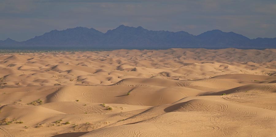 The Algodones Dunes Wilderness
|
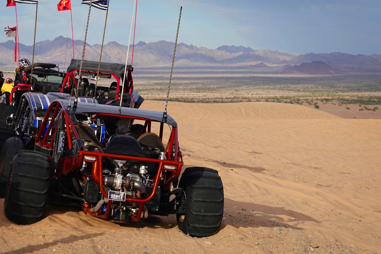 One of the many ATV's that roam the dunes. Day 8. In the morning before dawn we opened up one of the windows and were greeted by an amazing sight. Stars so bright they lite up the ground. A sight you don't see in the bay area. Our destination was Lake Havasu via Mohave Road and the Parker dam. But first we needed fuel. I found a place in Blythe just off the road only to quickly stop pumping. It came to me that I was in California and Arizona was just a mile down the road with considerably cheaper prices. We had never taken Mohave Road and I can sum up it's virtues, it's straight. We were really looking forward to touring the Parker dam. But as we approached there was a sign that said 'No RVs on the dam road.' Well, we're really only a big van so they can't mean us I thought. But as we got closer there were more signs, each one bigger than the one before with the same warning. Then we saw the barricade. It was about 5 feet something' wide and only Smart cars and Ford Festiva's with their mirrors turned in will get though that. Luckily there was a nice side road overlooking Lake Havasu and the dam which made up for it... sort of. We stopped briefly at several places along Hwy 95 taking a pleasant little hike on one of the little islands before settling into our campground at the Lake Havasu State Park. While we paid four times as much as our last BLM park, this was one of the cleanest, most spacious parks we've ever been at complete with asphalt pads and hookups. We only had time to take a short hike to the Cactus Gardens which had an economical volunteer feel but was very charming. |
|
|
| Day 9. After breakfast we hiked to the London Bridge about a mile from our campground. The bridge was a madhouse of boat and foot traffic having a mixed feeling of American and European cultures. The British part was quaint little pubs. The American part was a floating bar with an outboard attached for the bartender to propel you around the pond while you sipped your Pina Colada. On to the Wetlands Park at the Eastern side of Las Vegas. It was certainly developed from when we first saw it 15 years ago. The small old trailer had morphed into a massive new modern building complex housing a museum and auditorium with several miles of concrete trails around the nearby marsh from which you could observe the wildlife in a wheelchair even. It was very pleasant. On to Mimi's cousin on the Western side of Las Vegas. She's a delightful person who we barbecued some salmon for before retiring to our camper which we were able to park in front of her house. A win for everyone. |
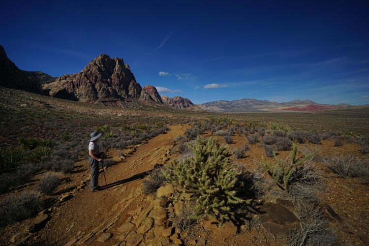 Overlook Trail at Spring Mt. Ranch
|
| Day 10. I had 3 parks to choose from for this day and gave Mimi a choice. After reading the descriptions she wanted to see all three! So we set off for the Floyd Lamb Park just north of the city. Veterans get in free, but a friendly veteran manning the gate let us in free in spite of not having proof of my military service. It was a pleasant park mostly for family picnics. At this point we looked at our time and decided we didn't have enough to see three parks so chose the Spring Mountain Ranch as our next destination as it was on the way and looked the most interesting. Well, we were a little disappointed. Parking was a problem, but mostly as we had a camper and tried to park backwards to shield our refer from the sun. Then in spite of being a resident of movie stars and billionaires, the structures were sub standard and the employees lukewarm. Still we enjoyed the beautiful Overlook Trail hike around the hill behind the parking lot. On to Death Valley and the Zabriski trail hike we had missed last year. We had a ways to go but sometimes it's fun to just relax and watch the scenery go by - especially if it's a bit warm and you have AC. Unfortunately it was getting to be too late to hike and we prudently searched for a campsite. As we went past Sunset it looked full and we were depressed as it wasn't that nice of a campground and usually fills last, so we had little hope of finding a place at Texas Springs. But it had plenty of spaces so we grabbed a nice spot and settled in. |
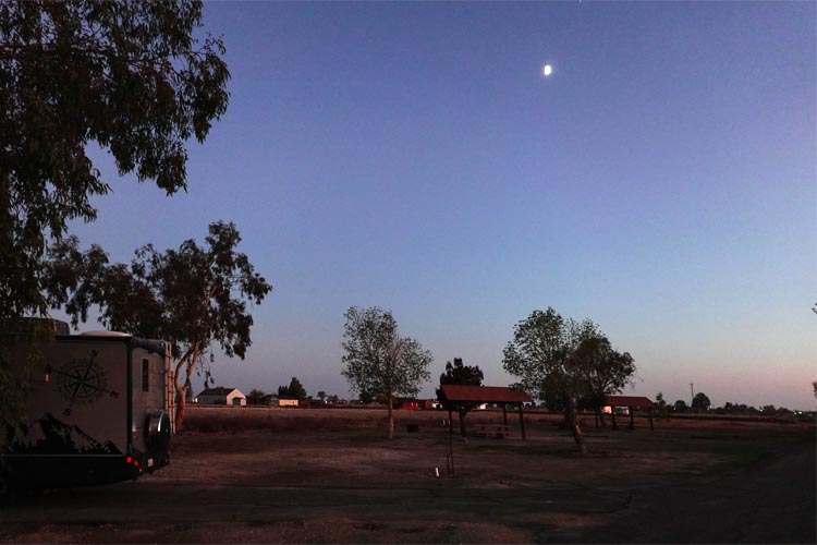
| Day 11. In the morning we backtracked, but only a few miles to Zabriski point. As it was now cool and we had time, we took the Badlands Trail loop. This was a typical of Death Valley hike with mudstone cliffs, amazing views and lots of desert flora (if dead ones count). We got a bit lost when a marked trail didn't go through but otherwise had a really good hike. At this point we had another problem. Where to camp. It was too far to go home and all interesting campsites part way there were either too close, too far or in the snow. There was only one possibility, Colonel Allensworth S.P. Campground near... well almost nothing in the central valley. I've read good reports though and it was about the right distance to get there by about 5 if we hustled. We took Hwy 178 over to Lake Isabella, a ride I have always enjoyed, especially on a motorcycle from years ago heading to Death Valley with friends. There were thicker forests of Joshua Trees here than at Joshua Tree National Park and amazing desert views along with small picturesque ranches and small towns. On getting to the lake I was a little confused with the route as it took us onto a small highway I didn't recognize, Hwy 155 directly to Delano. I had big time reservations as I'd seen this road on the maps before and knew it was extremely curvy but backtracking to Bakersfield was not an option at this late hour. Well it was 35 miles of torturous twists and turns so tight and steep we had to second gear it in several places and my arms were getting numb from turning the wheel. Plus it was getting very late as we saw the red sun starting to set. I put the peddle to the metal (which got us up to about the speed limit in our camper) on every straightaway I came to. As we got to Woody the roads started to straighten and we could manage 55 at times, but the sun was starting to settle behind the trees. When we got to Delano we thought we had it made, but every stop sign had a back up of 5 to 10 cars. Finally we got onto Hwy 43 and it was a straight shot to the park but the sun had already set. Luckily we still had the 'twilight' zone with another 20 or so minutes of marginal visibility. Our thoughts now were on 'what if the park is full', or 'what if it's closed for repairs' etc. Finally we spotted the park sign in near dusk and pulled in. Well, no locked gate so far. Another sign indicated the campground, partially lit by our headlights and when we rounded the corner it was empty! We were the only guests in this spacious clean well groomed park. And the cost was $18 for a level asphalted spot with a sheltered picnic table.
|
 |
Day 12. |
|
| Allensworth State Park. The old town as seen from our campground. |
| Some notes: Miles: We tried not to go too many miles in one day this time and managed to average only about 150 miles a day. I know many people go to one spot and stay there a week or even two which eliminates a lot of travel, but that's not our nature as we'd be bored to death. On Miles Per Gallon, most Class C's get from 9-11. Thanks to our little diesel we averaged 16.2. Cooking: Many nights I barbecue, which I consider fun as it's usually in beautiful surroundings. Plus it relieves Mimi from cooking. I've gone though 3 camping barbecues over the years and got rid of my Weber, then my Coleman due to the cleanup mess and/or tiny cook tops and finally got a 17" Blackstone griddle after a lot of research. I wish I had done this years ago as it's faster, easier, cleaner and does bacon, pancakes, shish kabob, stir fries and grills every meat from chicken to steak with one appliance. Plus cleanup takes about two easy minutes vs a real mess on a regular barbecue with grease and bottom scrapings all over. I was so impressed with the taste and cleanliness I bought one for the house and finally got rid of my regular barbecue altogether.
|