|
OUR NEW CAR
A bout a half year ago we decided our aging Honda CRV was due for retirement, and a new car was in order. But this time it would have to have four wheel drive as we wanted to go up to the Sierra's in winter and roam the back roads of the west's deserts occasionally where unique hikes were to be had. Looking around we narrowed it down to either a Jeep, Mercedes 350, or Toyota FJ. We finally decided on an FJ due to it's off road prowess and reliability. Appearance was also a consideration as we wanted something different from the standard SUV shape of a potato that had gone through wind tunnel testing.
After a few weeks of studying some of the best 4X4 roads
in Death Valley, we chose a few that were not too
extreme for our novice abilities, yet interesting enough
to endure an hour or so of crawling along dirt roads at
15 mph, a speed that keeps the car in one piece. Marble
Canyon out of Stove Pipe Wells was one, and Titus
Canyon, an old standby, was another.
|
 |
MONDAY
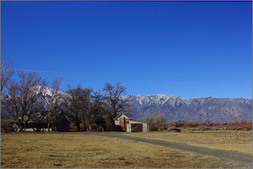
We took off about 7am from the bay area and made for Gardnerville taking advantage of Nevada's gas prices. Then down the scenic 395 which never ceases to impress us. Our first stop was Lake Crowley and the Lake Stone Columns we had just discovered. Well after about a half mile of getting on dirt road, we hit a horrendously bad section of loose dirt with a grade of almost 30% and foot deep ruts. We were apprehensive, but I put it into 4WD and then part way up into A-track. Except for one loud clunk which was either the big boulder, or our brakes activating, we crawled up effortlessly. Unfortunately our GPS wasn't accurate enough to keep track of the dirt roads and we had to wing it. The second problem is the lake was now higher and made beach access difficult without a boat, plus the lake was partially frozen to boot. But it was a nice ride and we conquered our first true 4X4 hill. On to Erick Schat's Bakkery in Bishop, a genuine European bakery with good ratings where we got a few supplies. Unfortunately it was a mob scene with high prices, but they had good stuff. We spent the night in Lone Pine and had a light dinner with a pint of local beer beforehand.
|
|
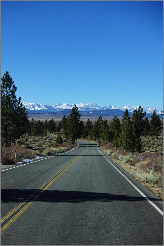
| Typical scenery driving down 395 on the Eastern Sierra's. |
|
TUESDAY The following day we headed for Stove Pipe Wells seeing sights along the way. What was memorable was the Owens Lake migratory stopover. A century of drawing from the river by farmers and Los Angeles decimated the lake, and now it has been brought back to preserve wildlife. It's an eerie desolate place yet beautiful in an austere way.
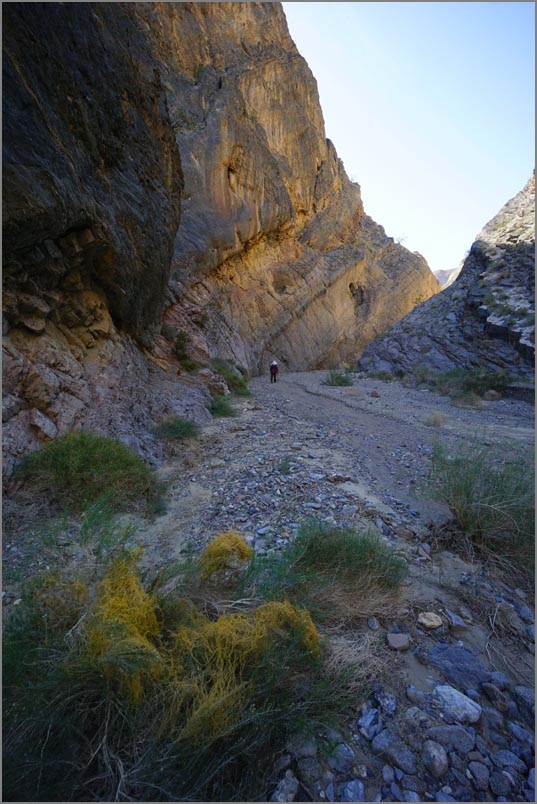
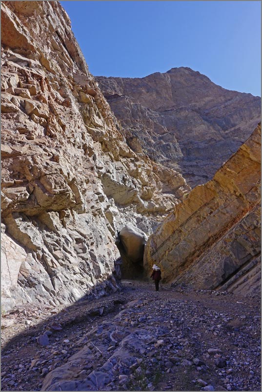
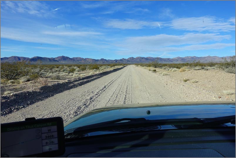
At Stovepipe we got off road to take the Marble Canyon hike at the end of a
15 mile dirt road, the last 2 miles are for high clearance vehicles only. It
may sound like a short drive, but due to washboards, then ruts, and finally river washes
one can't go faster than about 10-15 mph. Marble Canyon was a geologic
wonderland of convoluted strata, limestone beds loaded with chert nodules,
and a giant chockstone at the end. There was a trail around, but we were
behind schedule and had a ways to go to get back to pavement even. We stopped briefly at Zabriskie
Point to join dozens of other tourists at the overlook, but it's always amazing.
Unfortunately we didn't have enough time to hike into the valley as planned.
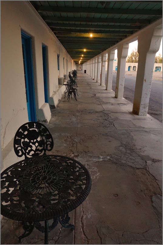
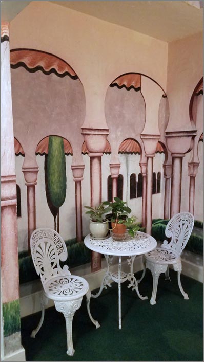
On to Death Valley Junction and the iconic Amargosa Opera House to spend the
night.
If you enjoy returning to the 50's, this hotel is the place. Bought in a
dilapidated state by a young New York lady on a trip in the 60's, she returned here with
her husband to spend the rest of her life fixing it up and creating theater
for the locals. With her passing in 2017, the place is now a non-profit to
her memory and the hotel.
|
|
|
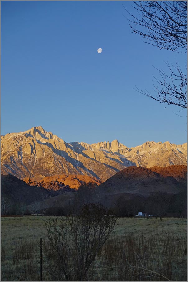
| Early morning Sierra's as seen from our hotel in Lone Pine |
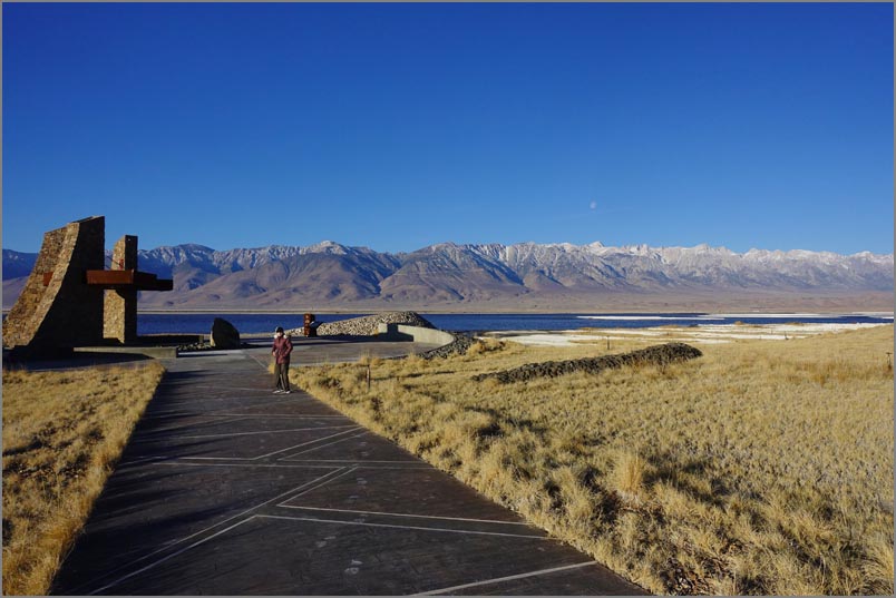 Owens Lake with the Sierra's in the background. |
 |
|
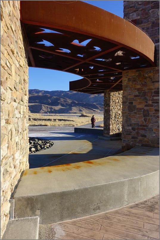
| A monument to the restoration. |
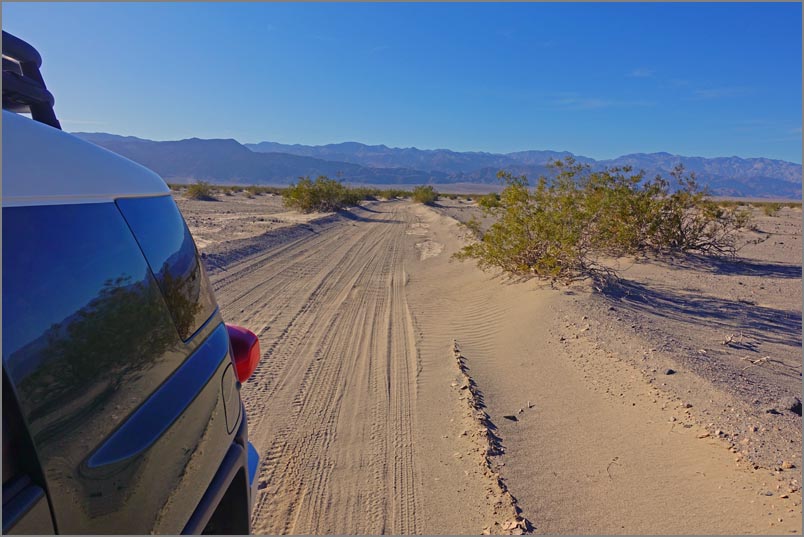 Marble Canyon road as it looks for the first 8 or so miles. The FJ took washboards better than most cars, but we didn't dare air down as had no compressor to pump the tires back up. After 8 miles the road gets more rocky and then enters the first canyon. After that it becomes an even rougher road but only for two miles. |
 |
|
| Marble Canyon after about a quarter mile. |
 |
||
|
The giant chockstone at the end. We understand you can go around
easily enough, and the trail gets even more interesting, but we lacked the
time.
|
|
 |
 |
|
| The Amargosa Opera House - a grand old lady. | One of the many murals inside. |
 |
 |
|
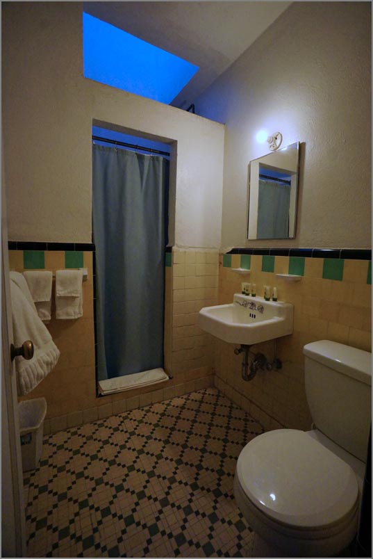
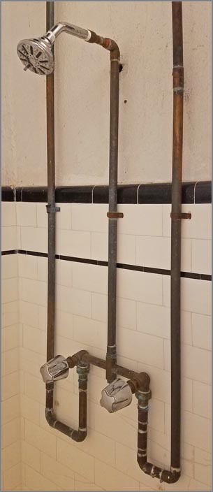
| 50's tile and fixtures make for a unique ambiance. | The bare copper pipe was ok, but the 10 minute wait for hot water wasn't. |
|
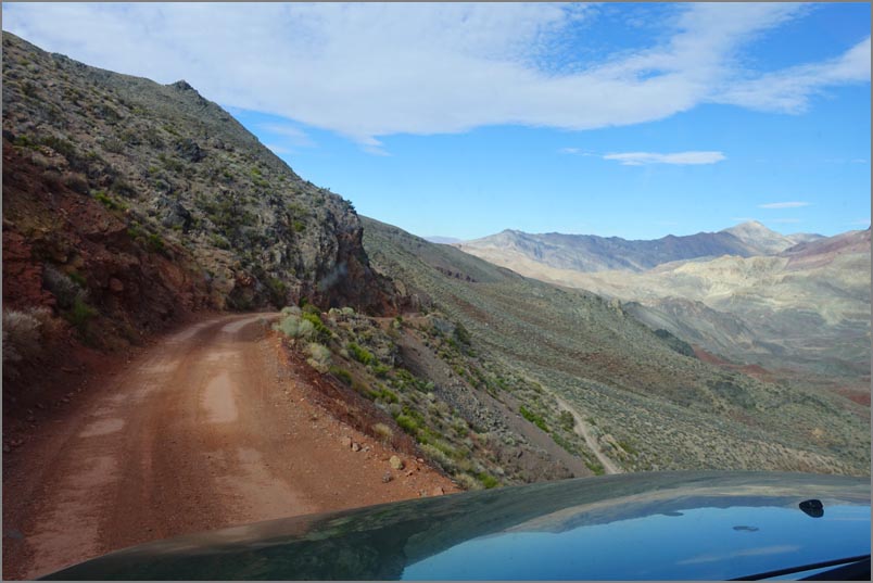
WEDNESDAY
The following day we again gassed up in Nevada and
headed for Titus Canyon, one of the parks most famous
dirt roads. We did this in a VW bug about 45 years ago,
but barely remembered any of it. Now I doubt a sedan
would make it as there are some sharp uphill curves with
deep ruts. We stopped briefly at Leadfield, the only
settlement that existed on this road, a failed mine that
died within the year due to a ponzi scheme. The road is
very scenic with a cornucopia of interesting geology,
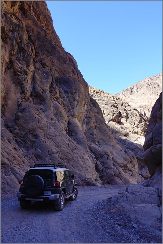
but the end with it's towering walls only a dozen feet
apart is the highlight for most people. From here we
headed to Goldfield, a gentrified Ghost town designed to
attract tourists. The locals seem to have a knack of
preserving everything old, and decorating them if new.
|
 |
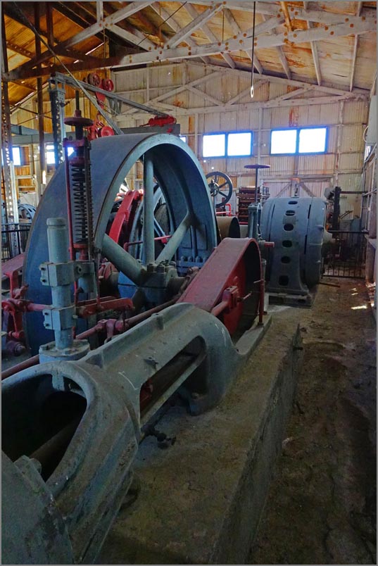
We rushed to Tonopah after that in hopes of getting to the historic Mining Park in time. We got there about an hour before closing but no one was at the visitors center so we explored the site on our own. It was one of the more fascinating machinery sites we have seen all brought about by a lady no less. About a 45 minutes into our visit we spotted a big serious looking man waiting for us who said the place was closed. As often happens, the web site said nothing about winter hours. But he was nice and simply led us out. Luckily we had seen much of the site and now headed to our hotel and then the Tonopah Brewing Company just across the street. It had some wonderful beers brewed right on site. | |
| On the road to Beatty early Wednesday morning. |
 |
 |
|
| TTitus starts off with a long ride across the Amargosa Valley | Titus Canyon higher elevations. |
 |
Click here for a one minute video of the canyon ride through the narrows. | |
| Titus Canyon as it enters the narrows. |
 |
||
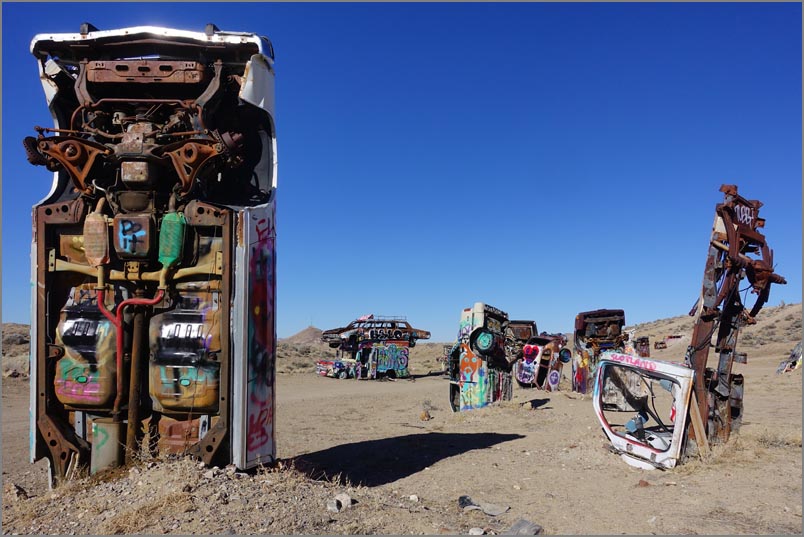
| The Goldfield "International Car Forest" is a kick and worth a few minutes. |
 |
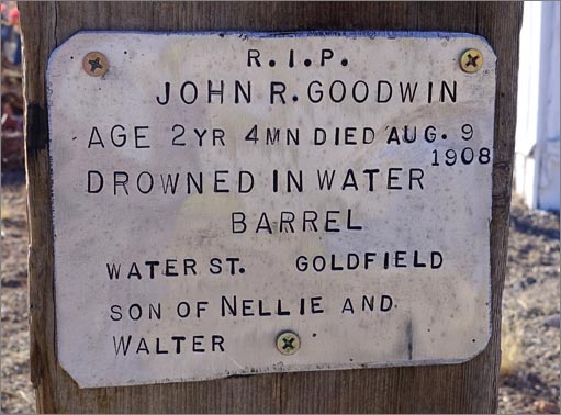 There we spotted this sad memento. |
|
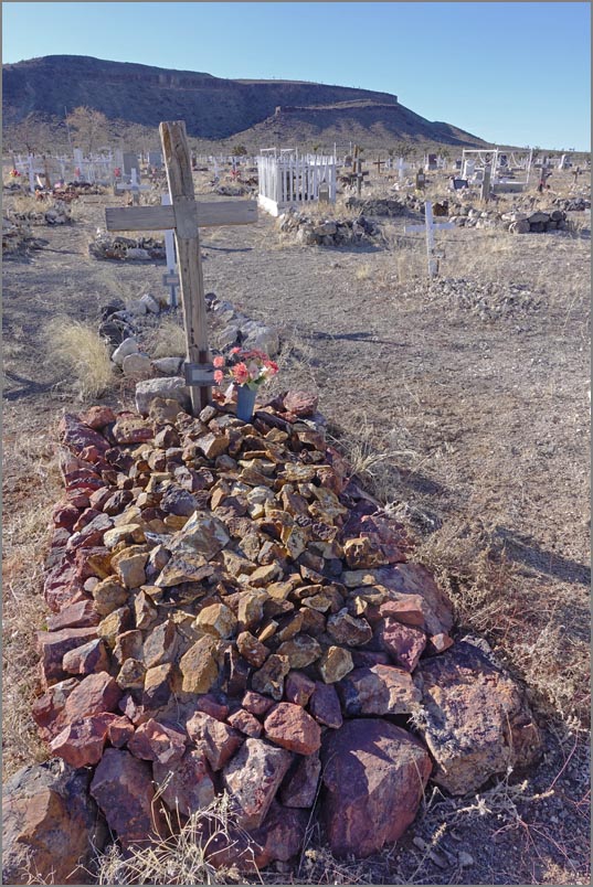
| The Goldfield cemetery is stark but interesting. |
 |
 |
|
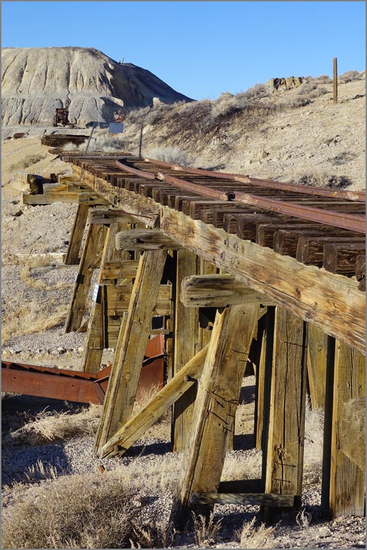
| The Tonopah Historic Mining Park covers many acres and is easily worth an hour or more. See their web site here. | Part of the grounds at the park. Even more interesting is the collapsed sections of tunnel. |
 |
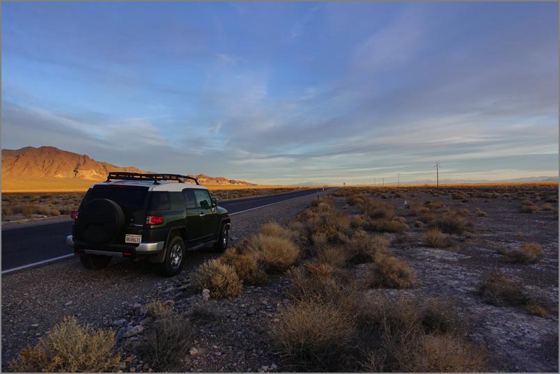
THURSDAY The next morning we headed home by plugging our address into the Garmin GPS. Unfortunately it took us west on 6 and over Hwy 120 which it didn't know was closed for the winter season. This created a 45 minute detour by having to go down to Bishop and back up again. Later on I found that there was a small road we could have taken that was still open. Ah well, the cost of not being plugged into Amazon maps and the cell towers. We pulled over for a picture just before Bishop (at least the detour was scenic) to take a photo. On getting back on the road, we heard a loud knock and humping sound. In near panic I pulled off the road again suspecting a flat tire. On grabbing the emergency brake, I found it was up still. The hump and noise had only been the emergency brake! The rest of the trip was without incident except for horrible bay area traffic. |
|
|
GPS COORDINATES OF SIGHTS: Crowley Lake Columns: 37.607556, -118.718797 Marble Canyon trlhd: 36.618707, -117.330646 Amagrosa Opera House in DVJ 36.302038, -116.414664 Titus Canyon 36.85937, -116.84573 Goldfield Art Car Park 37.707963, -117.234504 Goldfield Cemetery 37.717420, -117.247831
|