| We
decided to head up north towards Canada this spring. It had been a while since we've been to beautiful Vancouver Island with it's very English capital of Victoria and the amazing Pacific Rim Forests. Our furthest destination would be the huge remote Strathcona-Westmin Provincial Park set in the very center of the island. Our first day was a long one so as to get us into new areas as quickly as possible. Our first camp was Oregon's Valley of the Rogue State park set right along Hwy 5. It was a very pleasant surprise with clean well developed camp spots nestled among mature trees for a modest price. We enjoyed it's pleasant River trail for a few miles before dinner.
|
 |
 |
|
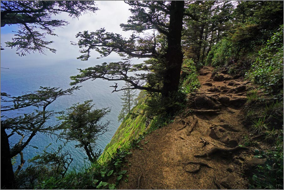
| Cape Lookout Trail | On one side is the mountain and on the other is a 300' drop into the Pacific. |
| Our next destination was Cape Lookout on the coast of Oregon about 60 miles west of Portland and slightly south. I've been using Alltrails and it gave the area great ratings especially for the Cape Lookout Trail. We got there about noon and wisely went to the campground first as it was starting to fill up. Then backtracked a few miles to the trailhead. This was a world class hike and rivaled Newfoundlands Skerwink Trail. At just over 5 miles it first went through dense, spruce, hemlock, pine and cedars. Then opened up on one side to a steep cliff with views of Oregon's southern coastline as it followed the peninsula. We heard several whales spouting at the end, but unfortunately when we were finally able to follow the sound they were in the process of submerging again. Reluctantly we turned around as it was a long way back on a root bound trail. |
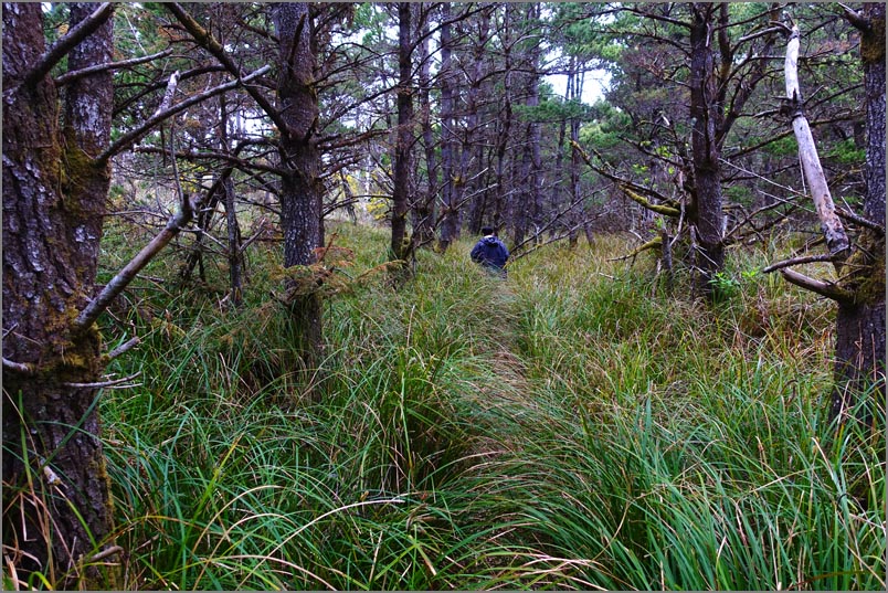 |
In the morning, we had time to take the Netarts Spit Trail. At first it wasn't much just following an old paved road, but as we were about to turn around we saw some trees ahead and decided to go just a little further. Just past and under those those trees it turned into a surreal climax forest of sedge grasses and pines cut by only the smallest of trails. | |
| Netarts Spit Trail |
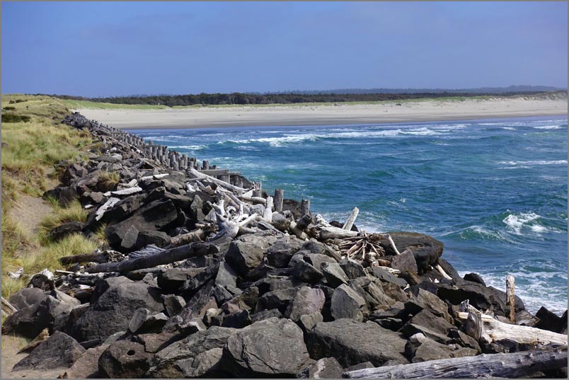
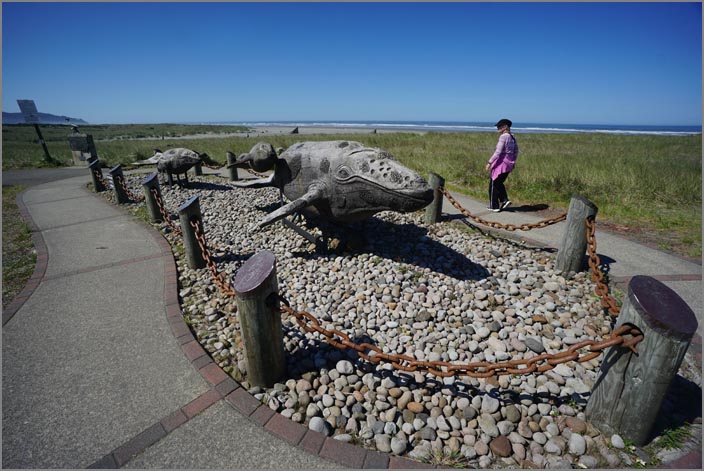
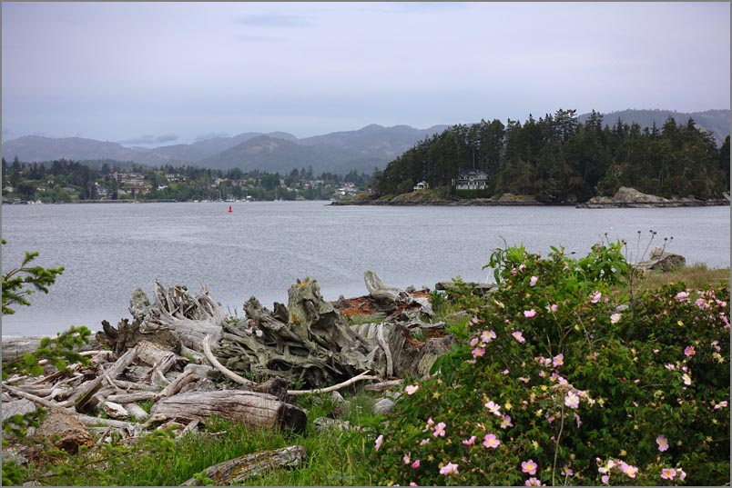
| Our next destination was Fort Stevens located on Oregon's most northwest corner. While the setting was wonderful, the fort unfortunately was only a skeleton of it's former self with dedicated volunteers taking care of what was left. After checking in we took a pleasant hour tour on an old army 'duce and a half' around the site, though I'll never think our camper as being too loud, large or rough again. Afterwards we drove to the spit for a short boardwalk hike out to the Wildlife Viewing area and then to the Jetty Observation Tower where one could see the waves pounding this rugged shoreline protected by massive riprap stones. |
 |
|
| Jetty Observation Tower |
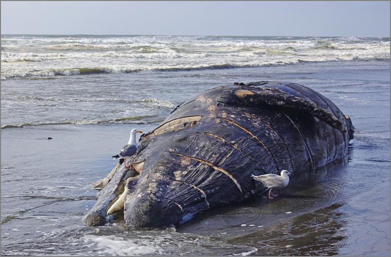 Baleen whale I believe |
We stopped briefly under the Astoria - Megler Bridge but had too little time
for the Astoria Riverwalk we hoped to take. Instead we crossed the river for
a quick look at Fort Columbia before heading further west to Cape
Disappointment. Our first order was to find a campsite hopefully right next
to the beach. Luckily we got one of the last three sites. We've learned to
get a site as soon as possible as towards 5pm we see many people drive in
only to see everything filled. This was the first full hookup and we decided
to take advantage of it.
As most of the rigs come for a week, everyone had a fancy sewer hose
supports, but my pile of rocks worked just fine. Hopefully no one noticed.
We had about an hour before 5pm, so strolled the beach. Unfortunately it was
not only strewn with the biggest log jam of washed up wood, but a dead
whale. We approached cautiously and I took a few shots and were going to go
past when the stench hit us. We quickly turned around to headed up wind.
|
|
|
The next morning we tested our shower out for the first
time and the new thermostatic valve I had installed. It
worked perfectly holding the temperature where ever we
set it.Now we only had the on and off valve to deal
with. This cut our water usage attempting to get the
temperature right by about 75%.
After cleaning up and having breakfast we took two very
nice hikes in the area and then drove to the boardwalk.
It must have been low tide as the beach was nearly a
quarter mile wide, the most I'd ever seen. We walked a
few blocks of Long Beach and then headed to Pe
Ell. Here we had relatives and enjoyed the evening
catching up on all the news over a few glasses of wine
or beer and had a nice pot luck afterwards. Back in our
camper we went over the Canadian part of our trip as I
hadn't had a chance to really plan out the daily
schedule. I soon realized we had no hope of seeing more
than about half of the places I had intended with our 3
day scheduled stay. On doing a little math I realized Strathcona-Westmin,
added over 500 miles to our trip. As this was one of
only two parks in that area, it was the obvious choice
to eliminate, and it would let us attend of our southern
destinations in leisurely fashion, something we rarely
get to do it seems.
|
 |
 |
|
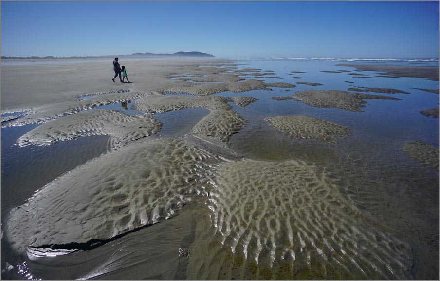
| A sculptural scale model of a whale and calf. | Long Beach was now Wide Beach |
 |
We took off early for the next morning for the Port Angeles - Victoria ferry enjoying the drive along the Hood Canal. In spite of getting there 90 minutes early, it took much of that to do the paperwork, get measured, and be assigned a spot. After that we really enjoyed the ride over. On getting to the other side I drove off and realized to my horror that Ms. Garmin (our name for the GPS) didn't have a Canada map! After customs we pulled into the first parking space a few feet away only to have the Canadian police ask us what we were doing here. We said we were lost and needed some time to get oriented. They said this parking space was for a complete inspections only and unless we wanted one we should move. We lost no time moving to another place a few blocks away. It was then I remembered my cell phone and the HereWeGo app. This little application guided us flawlessly around Newfoundland last year and is completely free! | |
| We knew we would arrive at our campground late and as it was Friday we had a site all set up ahead of time at the Goldstream Campground, a pretty little park only about 12 miles (now 18 km) away. Unfortunately rush hour in Victoria is as bad as any other metropolitan town so took twice as long to get there as usual. While waiting in the park entry line we saw camper after camper being turned away, so our planning paid off. We hooked up and enjoyed an evening stroll after dinner. Apparently this was a popular family park as there were dozens of kids in two huge playgrounds running and screaming. So I guess there is still life outdoors in spite of computers and cell phones. |
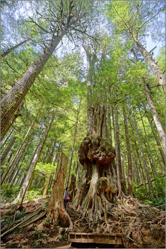
| Saturday we looked over our itinerary and decided to head right for Port Renfew seeing as many sights along the way as we could and yet get there at a reasonable hour for a camping spot. I hear a lot of criticism about California roads. Well Canadian roads may be better, but only marginally so. We found plenty of potholes and poorly patched ones here also, and on the way to Renfew we could only do 35 in many places where the speed limit was 50 due to patches and heaves. At Renfew we headed right for the Pacheedaht Campground on the Indian reservation as other places were full up being a Saturday I assume. After securing a place, we headed right for the Avatar hike we had heard so much about. If the last two miles to the trailhead were any worse, we would have needed 4 wheel drive. And to boot we ran into a large group touring the trail. But everyone was very nice and we accommodated each other usually by going in opposite directions. This has to be one of the grandest examples of old growth fir and spruce forests on the west coast and we were impressed. The only caveat was some of the most popular trails were trampled and dusty. As it was only about 3pm we took off back down the cobble stone road trying not to lose too many parts off of our camper and headed to the Botanical Beach Park, another highlight of the area. In the parking lot we talked to a fellow camper comparing notes and problems and then headed down another lush trial to the beach where we saw a bear and two cubs in the distance scavenging for food. I'm not sure if they knew about the restrictions on taking marine animals though. |
 |
 |
|
| The Avatar hike and “Canada’s Gnarliest Tree” | Botanical Beach trail |
 |
 |
|
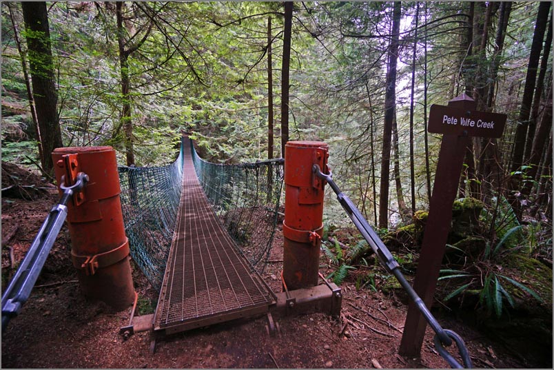
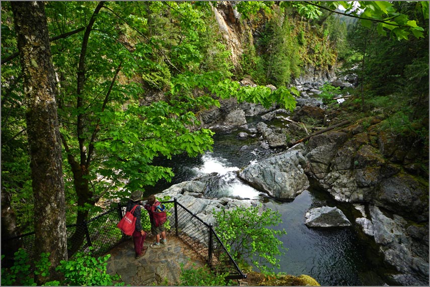
| Juan de Fuca Marine Trail and the suspension bridge over a 100' gorge. | Large cobbles typical of China Beach |
| After a gourmet camper breakfast (hash and eggs) the following morning we took off back towards Victoria. One of the highlights was the Juan de Fuca Marine Trail out of the China Beach. A beautiful woodsy trail with lots of boardwalks and a unique suspension bridge. A friendly English lady joined us to to make the hike more enjoyable. The next highlight was the Whiffin Spit Trail. It wasn't world class but a most pleasant stroll along a level spit with harbor and town views on one side and ocean views on the other. |
 |
 |
|
| Whiffin Spit Trail | Sooke Potholes Provincial Park is worth a stop if close by. |
 |
 |
|
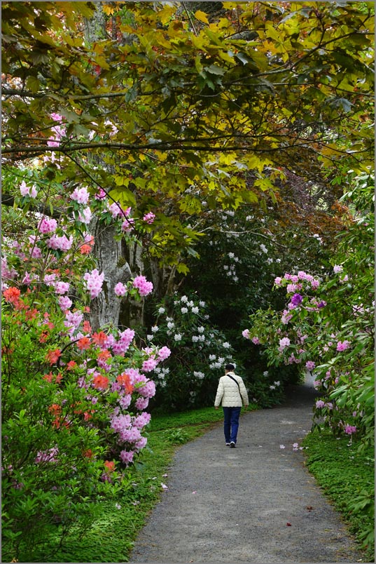
| Hatley's magnificant Japanese garden |
| Our next major stop was the magnificent Hatley Castle. After going down a one way street towards the castle and coming to a low over pass, I had to back out again into traffic with the help of an attendant (what the Canadians have to put up with from us tourists). It wasn't the size, though it was large, but the quality of workmanship. Plus it looked oddly familiar. Later on we found out why. It was the home of Xaviers gifted children in the X-Men movies. As it was now another type of school, we couldn't enter, but were free to walk the grounds, and what fabulous grounds they were... and free! We have never seen such a splendid Japanese garden. |
 |
 |
|
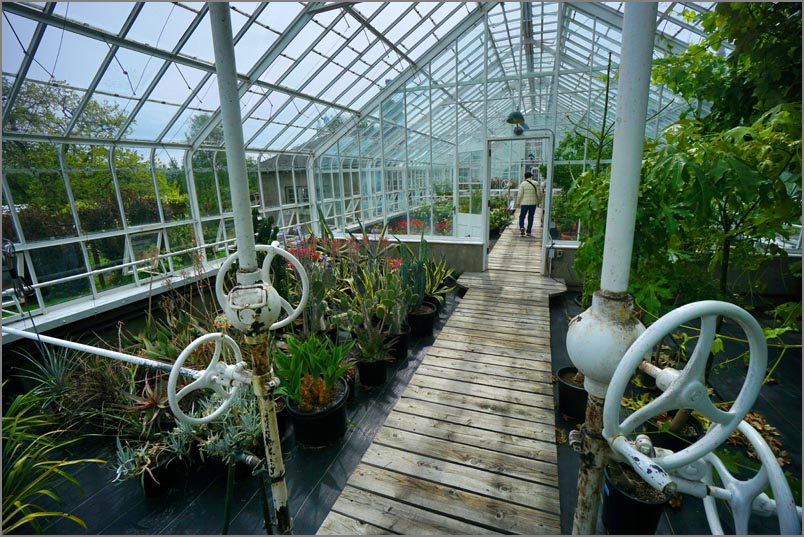
| Hatley Castle greenhouse and house garden |
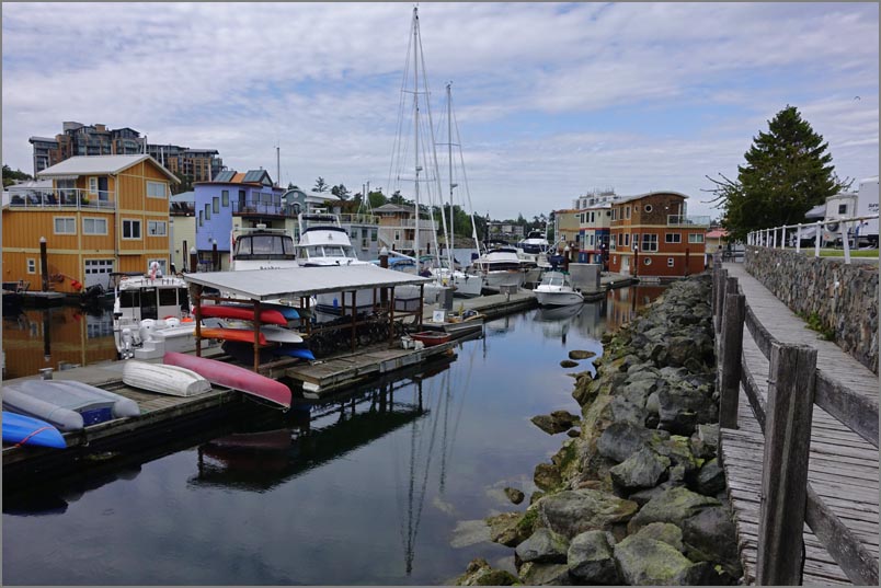 |
That night we had reserved a site at the Salish RV park. To say this was a normal park would be to say a spot on the Marin coast overlooking the city of San Francisco was normal. Besides seeing Victoria up close and being scrupulously clean it sat nestled in a quaint little harbor. We chose this as it was only 3 km from the ferry we had to catch early. Ironically it's owned by Native Americans. | |
 |
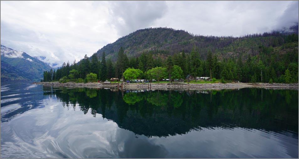 The following day we headed for the USA and slowly towards Lake Chelan where we had booked a boat ride on the 'Lady of the Lake' which would take us from Chelan to the small village of Stehekin at the end. The 100' ferry puttered along at about 14 mph covering the 45 or so miles in 4 hours. It stopped at several places to let passengers off and on by simply running into the shore bow first until the beach stopped the boat and then letting out the gang plank. Some got off for the 18 mile Lake Shore Trail, and others for the forest service. They said it was a half years wait to join the forest service work list. 8 hours is a long day but one could walk around the boat and the views were never tiring. |
|
| Our ferry plying Lake Chelan |
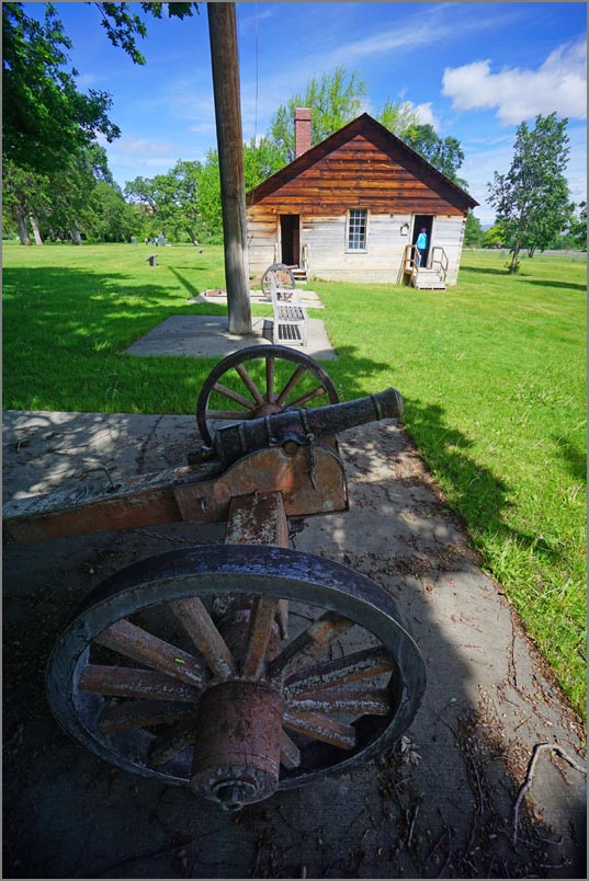
| We again camped locally and took off for Fort Simco the next morning. On the way we came closer and closer to our next hike, but so did the summit of highway 97. Both appeared at the same time. Our hike was in the middle of a snow park complete with snow so we prudently skipped this one. At about the same time I shifted gears manually and the camper all of a sudden went on half power. ( Good things come in pairs I've heard.) My mind raced on what would be open that could repair a Mercedes Sprinter on Sunday if we could even make it back to Wenatchee. Before turning around I stopped and turned off the ignition, waited a minute and restarted thinking if it was a computer it might clear and reset. Well it did and ran strongly after that - sort of. It seems it kept missing from time to time. Later on on the long ride home I paid more attention and it missed once every 6 seconds but we could at least keep going. (Days later at home the dealer discovered an air intake hose had cracked and kept opening and closing due to heat setting off the computer glitch.) |
 |
 Deschutes SRA River Walk trail |
|
| Fort Simco |
|
We liked Fort Simco in the middle of an Indian
Reservation, not because of it's history or
restorations, but the weather was so perfect, the
lawn so expansive, the sounds so quiet and we had
the place nearly to ourselves. So we happily
wandered around for the next 45 minutes poking our
heads into all the house windows and went into all
the structures that were open. Then had a nice lunch
overlooking this pastoral scene out of our campers
picture window.
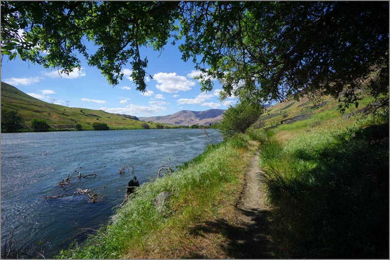
From here we had just enough time to make it to the
Columbia River and the Deschutes SRA to look for a
campsite. When we pulled up we spotted a ranger and
anxiously asked if there was any space left. He
slowly drew a big breath and looked at us (which
didn't seem like a good sign), and said "Well, we
just opened up the newly paved section A this
morning with hookups and there are only a few people
in it". We looked the sites over but all were
perfectly level and clean, so picked one feeling
very lucky. Afterwards we took the Riverview trail
for about two miles. In the middle Mimi was ahead of
me and suddenly froze calling my name. On coming
closer and then looking over her shoulder I saw a
large rattler two feet away coiled to strike. She
slowly backed up when struck, missing by just the
amount she had retreated. After that the rattler
took off in the grass. It left us both a bit shaken
and we thought the next time we're in grassy terrain
we might just put on gaiters.
Our second to last destination was Fort Rock, an
old volcano rim located in the middle of Oregon
and in middle of nowhere - at least population
wise. We had stopped here years ago but didn't
have time to hike and the weather was
sweltering. It's almost a mile wide and a unique
site for anyone wanting an interesting hike.
Finding a camping place is always a problem,
especially if you don't care for RV parks and
there are no other options for miles around.
Well, we found a large lot at the local Fort
Rock restaurant and asked if we could spend the
night in their lot after having a meal there.
They agreed and said trucks and campers were
always welcome. About 5 we went into the diner
and ordered two tap beers, a nice salad and
chicken dinner I believe. The bill came to about
$35, that's for the two of us including the tax,
tip and beer. I don't think one person could do
that well in the Bay Area. Plus we had a place
to stay for free!
Over breakfast the next day we discussed two of
our remaining problems... our itinerary and
fuel.
I had planned on stopping half way back which
would be Lake Shasta. But we would get there too
early and the hiking I had planned wasn't long
or interesting enough to spent 4 or 5 hours
doing. So we thought about just striking for
home as we could be there by about 4pm. The
second problem was fuel. We had plenty, we
thought, when we came out here. But out here is
a long way. And it's a long way back. We had
possibly 120 miles left and the nearest diesel
was about 110 miles away in the direction we
wanted to go, far too close for comfort. Or we
could backtrack about 80 miles and lose almost
160 miles by going in the wrong direction and
making getting home really late. Unsure of what
to do we broke camp and were hoping to find
someone who knew the area. Well, we went down
one side street in this town of 72 people and
found a crusty older fellow who really knew the
area, and had a diesel pickup. He said there was
a small station in Silver Lake (pop. 76) that
has diesel and it's open. With some trepidation
we headed that way and found a small old greasy
looking industrial pump hidden in back of an
empty looking country store that pumped diesel
without any attendant or credit card
confirmations such as a zip code. It was not
only quick but very cheap, plus it it was only
about 3 miles out of our way so we were
ecstatic! The rest of the way home was an
uneventful long grind except for the constant
missing up the long grades.
|